
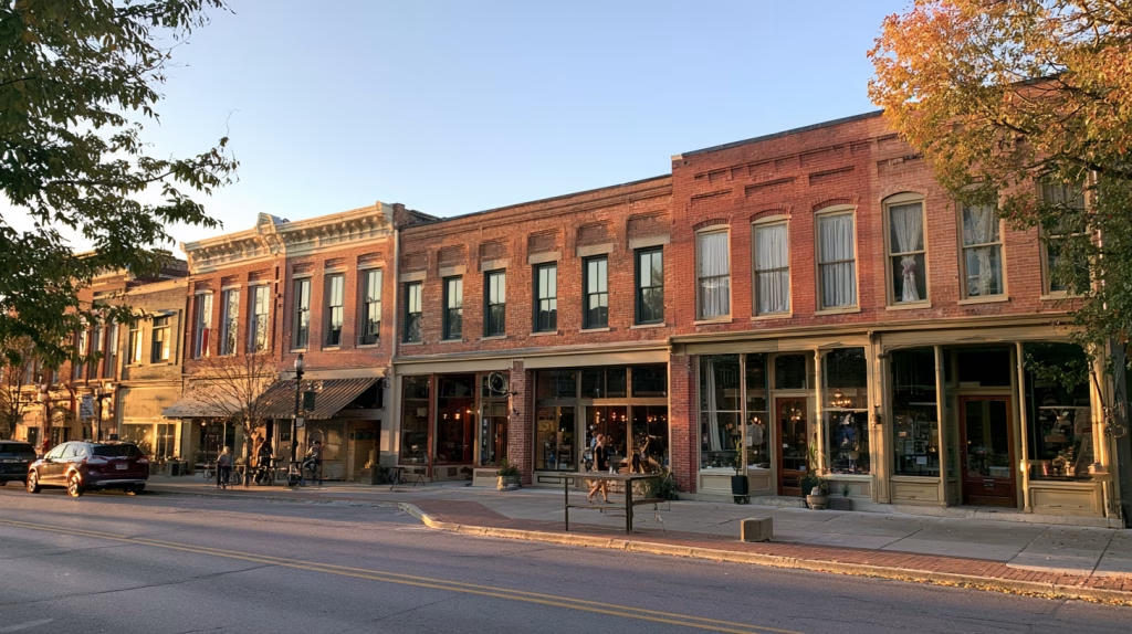
The building has stood at the corner for a hundred and eighteen years.
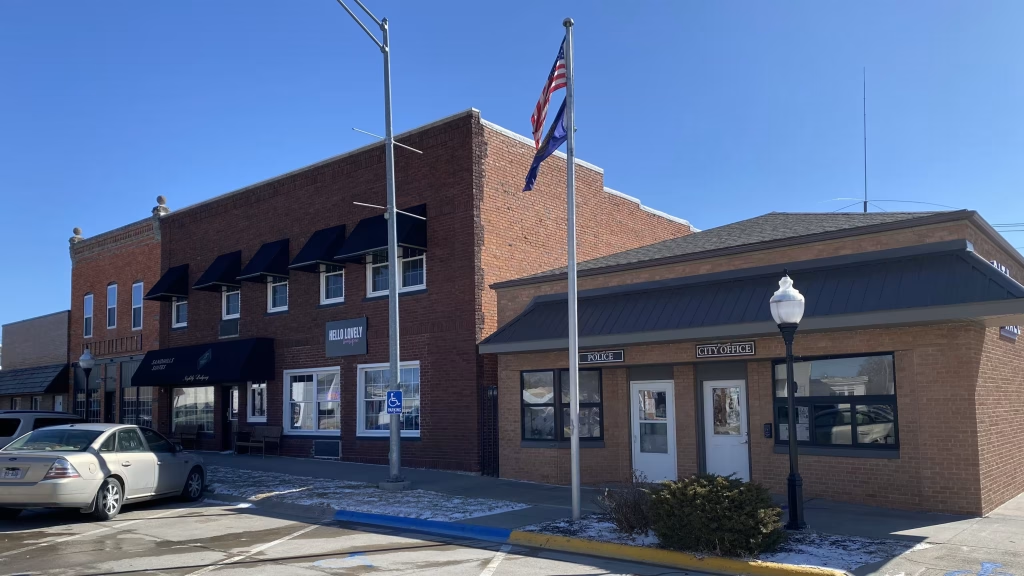
Red brick, two stories, cast-iron columns flanking a recessed entry, a limestone date stone reading 1908. The ground floor has held a dry goods store, a five and dime, an insurance agency, and for the last six years a coffee shop that also sells yarn. The upper floor has held nothing since 2010, when the last tenant moved out and the owner stopped heating it.
The woman who owns it now wants to put two apartments up there. Ground floor stays commercial. Upper floor goes back to what it was built to be. She has a contractor, a lender who is interested, and two people who have already asked whether the units will be ready by spring.
She checks the zoning ordinance first, which is more than most applicants do.
The parcel is zoned commercial. Dwelling units above ground-floor commercial are not a listed use in the commercial district — not permitted, not conditional, not mentioned. The ordinance was adopted in 1987 and amended in pieces for the next forty-eight years, and somewhere in that history the town quietly made it illegal to build the town the way the town was built.
Her building is nonconforming. So is the hardware store across the street, the apartment over the old pharmacy, the law office in a converted house on the corner, and most of the blocks that appear in the photographs on the cover of the comprehensive plan. The plan, adopted three years ago, devotes four pages to downtown revitalization, names upper-floor housing as a priority, and includes a future land use map with the entire square colored for mixed use.
So the town has a policy document that asks for exactly what she is proposing, and a regulatory document that does not permit it. Both were adopted by the same governing body. Only one of them controls what happens at the counter.
This is the third of four installments on land use this month. The first was about the future land use map — where it comes from and what it is not. The second opened the map to its largest category and asked what agricultural policy actually protects. This week we take up the instrument most people mistake for the plan itself. Zoning is not land use policy. It is one tool for carrying land use policy into force, and like any tool it can be sharp, dull, or pointed at the wrong thing.
The question I want to put in front of you is not which zoning system is theoretically superior. It is narrower and more uncomfortable: does your zoning code make possible the community your comprehensive plan says you want? I have spent the last several years writing these chapters for counties and small cities across the Midwest and Rocky Mountain states, and the examples here — Burwell and Kimball, Nebraska; Aztec and Bernalillo, New Mexico — come out of adopted plans, with the actual provisions and the actual numbers, because the gap between plan and code is not always visible in the abstract.
The Tool and the Plan
Zoning is often treated as if it is land use policy. It is not.
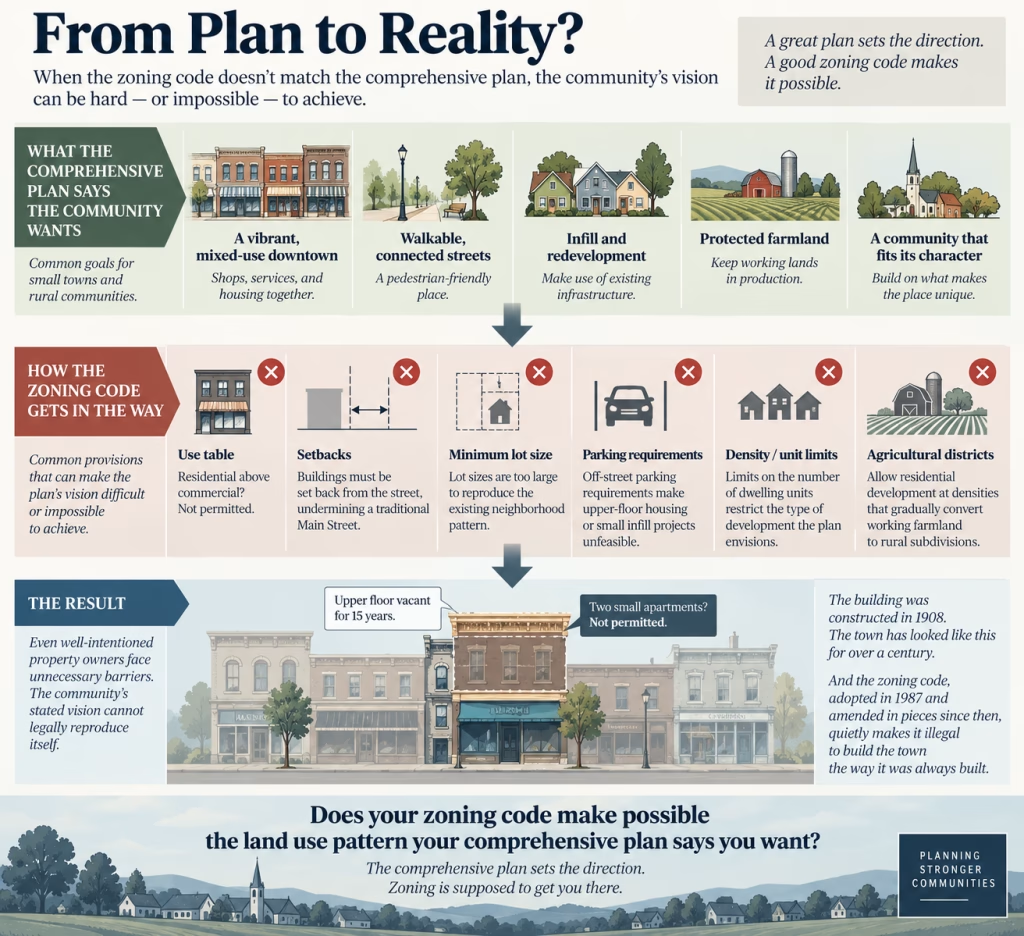
The comprehensive plan establishes the community’s direction. It is where residents, property owners, elected officials, and local institutions put on paper what they want their place to become: where growth should occur, what should be protected, how downtown should function, what types of housing are needed, which roads and utilities need attention, and what physical character new development should reinforce.
Zoning is one of the principal tools used to carry that direction into everyday decisions. It is not the only tool, and it should never be mistaken for the vision itself. But when a property owner walks in with an application, zoning is often the first—and sometimes the most consequential—place where the community’s stated priorities meet an actual proposal.
The Plan Sets Direction
A comprehensive plan is a policy document. Ideally, it is built from public meetings, surveys, maps, data, hard conversations, and the accumulated local knowledge of people who know which road floods, where the water pressure falls off, which block has lost three businesses, and which good farmland is beginning to sprout houses.
It may say that the community wants:
- A vibrant, mixed-use downtown.
- Walkable neighborhoods and safe streets.
- Infill housing on existing lots.
- New development that fits the scale and character of the town.
- Preservation of productive agricultural land.
- Growth where roads, utilities, schools, and public services can support it.
Those are not merely decorative statements placed between the community profile and the implementation chapter. They are the community’s adopted position on the future of its land, infrastructure, and development pattern. They represent a choice to invest here rather than there; to protect this resource rather than watch it disappear one small decision at a time; to reinforce the places already served by streets, water lines, schools, and businesses rather than continually chase new growth to the edge of town.
But a plan does not approve a building permit. It does not establish the setbacks for a new house, determine whether an apartment is allowed above a storefront, or tell a property owner how many parking spaces must be paved behind a building that was constructed before anyone thought to require them.
That is where implementation begins.
Zoning Makes Parcel-Level Decisions
Zoning translates the plan’s broad direction into rules for individual properties. It is the part of the local planning system that tells an owner, a neighbor, a contractor, a developer, a planning commissioner, and the person at the front counter what may be built or operated on a particular parcel, under what conditions, and with what limitations.
That sounds dry until someone wants to do something with a piece of land.
A family wants to divide a large lot for another house. A business owner wants to add a small warehouse behind the shop. A farmer wants to open a farm stand, host seasonal events, or add a small processing operation. A homeowner wants an accessory dwelling for a parent, an adult child, a renter, or a caretaker. A downtown building owner wants to turn an empty second floor into apartments. A solar developer wants to lease ground outside town. A manufacturer wants room to expand without creating a conflict with nearby homes.
At that point, zoning stops being an abstract chapter in a binder. It becomes the answer to a series of very practical questions: Is the use allowed? Is a hearing required? How large can the building be? How close can it sit to the road or property line? Is there enough land for parking, access, drainage, and utilities? Will the proposal require a variance, a conditional-use permit, a rezoning, or a trip back to the drawing board?
Zoning governs permitted and conditional uses, lot size, setbacks, building height, density, parking, signage, access, landscaping, buffers, and the long list of other details that can make a proposed project routine, difficult, expensive, or impossible. It also governs the choices a community makes one parcel at a time—choices that may seem small when they are considered individually but become the physical pattern of the town or county when repeated over twenty years.
- The comprehensive plan asks, “What kind of community do we want to become?”
- Zoning asks, “What can happen here?”
Those questions are related, but they are not the same. The plan establishes the destination. Zoning is supposed to help get the community there.
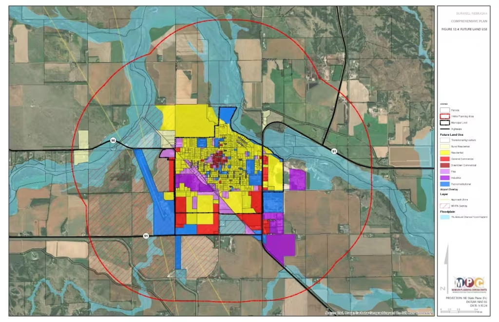
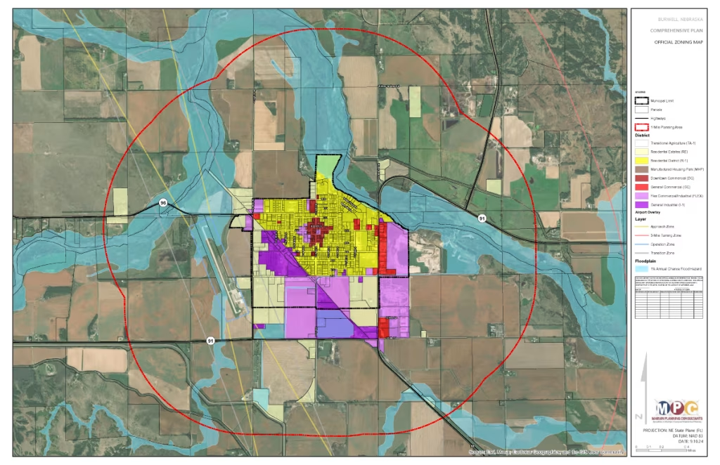
A zoning map is necessarily precise. It follows parcel lines because it has to. A particular lot is in a particular district, and the district carries specific rules. A future land use map works differently. It is more general because it expresses intent: this part of town should remain a stable neighborhood; this corridor can accommodate commercial growth; this downtown should support a mixture of shops, services, offices, and housing; this edge area should develop only when infrastructure can support it; this agricultural landscape should remain productive working ground rather than become a scattering of driveways and five-acre lots.
That is why the two maps should not be confused. The future land use map tells the community, landowners, staff, and future applicants what development pattern the community intends to support over time. The zoning map tells an owner what the rules allow today. One is policy. The other is regulatory. One is aspirational. The other has teeth, when we chose to use them.
The trouble begins when the maps and the rules stop talking to each other.
A comprehensive plan can identify a mixed-use downtown, a compact neighborhood, a preferred growth area, or an agricultural preservation area. It can say the community wants more housing choices, stronger Main Street businesses, orderly extension of water and sewer, preservation of prime soils, safer roads, or less scattered rural development. But if the zoning ordinance does not permit the uses, building forms, densities, lot patterns, and approval paths needed to make those outcomes possible, the plan is a promise without an implementation mechanism.
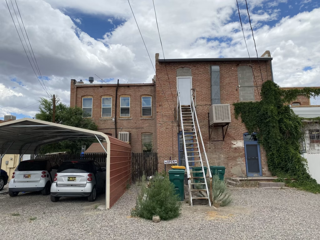
Consider a downtown designation on the future land use map. The plan may call for upper-floor housing, storefront businesses, small offices, walkability, rehabilitation of older buildings, and a district that looks and functions like the historic center of the community. Yet the zoning ordinance may permit only conventional commercial uses, require parking that cannot fit on an old lot, treat apartments over stores as a special exception, or impose setbacks designed for a highway commercial strip. The map says “downtown.” The code says “suburb.”
That is not a hypothetical. A few years back, I worked for the City of Aztec, New Mexico. More recently, when I was at Consensus Planning, we worked with the City on updating their comprehensive plan. Reviewing their Land Use Regulations at the time during COVID, the downtown commercial districts set maximum building height at one and one-half times the width of the adjacent right-of-way. Main Avenue has an 80-foot wide right-of-way, so the code permitted buildings up to 120 feet tall on a street of one- and two-story brick and stone storefronts built to the sidewalk. The number was not protecting anything specific. It was copied from the suburban strip of a typical state highway, and it bore little relationship to the historic district the plan said the community wanted to protect. The plan recommended replacing it with a contextual standard tied to the average height on the block, with an additional story permitted on corner lots.
Aztec’s code also illustrated a quieter concern: language that nobody can apply consistently. “Accessory Living Quarters” appeared as a permitted accessory use in the commercial and manufacturing districts but was never defined. “Accessory Dwelling Unit” was defined, cross-referenced to the neighborhood commercial district, and listed as a conditional use in the single-family district. Multi-family development was conditional in the neighborhood commercial district and in the North Main Overlay. An owner reading that code could not tell whether housing was allowed, allowed with a hearing, or allowed only as an afterthought behind a store. Neither could staff. Ambiguity is its own kind of prohibition, because the cautious answer at the counter is always no.
Consider similarly the rural edge of another county seat. The plan may identify agricultural land that should remain in production, both because it supports the local economy and because scattered acreage development imposes long-term costs for roads, emergency response, utilities, and public services. Yet an agricultural district that allows frequent residential splits can produce exactly the fragmentation the plan says it wants to avoid. A county can call that land “agricultural preservation” on a map, but the zoning rules will determine whether it remains a working landscape or becomes a gradual pattern of detached homes, long driveways, and service obligations spread across the countryside.
This is not an argument that every project should be allowed, that every zoning district should accommodate every use, or that a community should abandon the basic task of preventing incompatible development. Zoning has a real job to do. It protects homes from genuinely disruptive uses, helps direct growth toward places with adequate infrastructure, provides predictability for property owners, and gives communities a way to address safety, access, drainage, environmental constraints, and the cumulative effects of development.
But zoning is not successful merely because it says no consistently.
It is successful when it makes the community’s adopted vision possible in the places where that vision is supposed to occur, while providing clear and defensible limits where development would create real conflicts or costs. The test is not whether the ordinance is thick, old, or full of carefully numbered sections. The test is whether it helps a community build the place it said it wanted to become.
Building Codes Shape What Can Be Built or Reused
Zoning is not the only regulatory system that affects what people can do with real estate.
A property owner may clear the zoning hurdle and still find that a project lives or dies on the requirements that apply once the owner begins to build, renovate, repair, or reoccupy a structure.
Across the United States, the building-code framework commonly includes the International Residential Code (IRC) for one- and two-family dwellings and townhouses; the International Building Code (IBC) for commercial buildings and larger or more complex residential buildings; and the International Existing Building Code (IEBC) for additions, alterations, repairs, changes in occupancy, and reuse of existing structures. Other codes address the systems that make buildings safe and usable: the International Fire Code (IFC), International Plumbing Code (IPC), International Mechanical Code (IMC), International Fuel Gas Code (IFGC), and International Energy Conservation Code (IECC). Electrical installations are commonly governed by NFPA 70, the National Electrical Code (NEC).
That alphabet soup is not just a matter for architects, contractors, and code officials. It affects the planning conversation because each code can shape what is practical on a particular site. The controlling requirement is the edition and local amendments actually adopted by the state or jurisdiction—not necessarily the newest model code on the shelf—and that fact alone can create real confusion for a property owner trying to understand a proposed project.
For new construction, the distinction is usually straightforward. Zoning determines whether the proposed building and use are allowed on the site: the permitted use, setbacks, height, lot coverage, parking, access, and other land-use conditions. Building, fire, electrical, mechanical, plumbing, energy, and related codes determine how that building must be designed and constructed so that it can be safely occupied.
Older buildings are a different proposition.
A zoning ordinance may allow apartments above a commercial storefront, but a long-vacant upper-floor conversion can still trigger requirements related to occupancy classification, fire-resistance ratings, fire separation between uses, sprinkler or alarm systems, exits, stairways, emergency lighting, accessibility, structural conditions, insulation, plumbing, heating and ventilation, electrical service, and wiring. A building from 1908 does not come with an empty chase for new plumbing stacks, a modern electrical panel, a second enclosed exit stair, or the clearance that a contemporary accessibility standard may require.
For a historic Main Street building, those issues can be decisive. The apartments may be allowed by zoning, but the project may still depend on whether the owner can provide a compliant second exit, separate the commercial and residential portions of the building, upgrade old wiring and electrical service, find room for mechanical equipment, or work through the requirements triggered by a new residential occupancy. And that is before anyone begins discussing what changes when there is food service on the ground floor.
None of this means building, fire, or electrical codes are the problem, or that a community should waive life-safety protections in the name of economic development. They exist to protect occupants, first responders, neighboring properties, and the public. The question is whether local staff, code officials, and property owners understand the lawful pathways for safe rehabilitation and whether a jurisdiction administers its adopted standards clearly, consistently, and early enough for an owner to make an informed decision.
Communities that want historic preservation, adaptive reuse, downtown housing, or incremental reinvestment need to understand that those outcomes depend on more than zoning. Land-use rules, locally adopted building and fire codes, electrical requirements, permitting practices, early coordination among departments, and local technical capacity all affect whether a good idea can become a real project.
Aztec took that problem seriously enough to write it into the plan. When residents were asked what the City should do to protect its historic assets, 45 percent chose revising building codes to accommodate historic buildings — nearly as many as chose direct financial assistance. The plan responded with a set of linked strategies: designate historic overlay districts on the zoning map, create a Historic Landmark Commission charged in part with determining appropriate revisions to the building code for historic buildings, and work with the state Construction Industries Division, the State Historic Preservation Office, and San Juan County on legislation to better accommodate the challenges historic buildings face in meeting current code. That is a small city acknowledging that its preservation goals live partly outside its own ordinance, and deciding to go work on the part it does not control.
The Regulatory System Has the Teeth
This is where plans and regulations can drift apart.
A comprehensive plan may call for mixed-use downtown investment, small-scale infill housing, walkable neighborhoods, and development that fits the existing character of the community. But the zoning regulations may still require large setbacks, prohibit mixed uses, mandate parking that will not fit on historic lots, or require lot sizes that make the traditional development pattern impossible to reproduce.
The building code process may add another layer of complexity for vacant or underused older buildings, especially when a property owner cannot get a clear early answer about what will be required to bring a building back into safe, legal use. A project can get lost between departments when zoning staff see a permitted use, the building official sees a change of occupancy, the fire official sees an egress or water-supply issue, and the owner sees a price tag that no longer resembles the project they thought they were proposing.
When the plan and the regulatory system point in different directions, the regulations usually win. Not because they should, but because they are enforceable. The plan guides policy; the regulations determine what can actually be approved, financed, and built.
And that gap is where a community’s vision quietly goes to die.
A Code Can Defeat the Plan in Practice
There are many ways to do zoning. And the question is not which zoning system is theoretically superior.
The broader conversation about zoning reform has become increasingly visible in recent years. It often centers on large and growing metropolitan areas: eliminating exclusive single-family zoning, legalizing duplexes and accessory dwelling units, reducing parking minimums, encouraging transit-oriented development, increasing housing supply, and addressing the accumulated effects of exclusionary land-use practices.
Those are important conversations. They are also not always the conversations a small town or rural county needs to have first.
A rural county with more miles of gravel road than curb and gutter, a county seat with a struggling courthouse-square business district, or a town with a few hundred homes and a vacant upper story above the hardware store is not simply a small suburb waiting for metropolitan zoning reform to arrive. Its land market, infrastructure capacity, development pressure, staff resources, housing needs, and political realities are different.
Euclidean zoning, form-based codes, mixed-use districts, overlay districts, performance standards, and the many ideas collected under the broad label of zoning reform each have their place. A mayor, county commissioner, planning-board member, or small-town administrator does not need a seminar on every reform model before asking a more practical question: Does your zoning code make possible the land use pattern your comprehensive plan says you want?
And then one step further: Does the code make that pattern realistically buildable—not just technically permitted?
That distinction matters.
Legacy Assumptions Can Conflict With Today’s Goals
Much of the regulatory logic behind conventional zoning was built around separation: residential uses here, commercial uses there, and industrial uses somewhere else. There are good reasons for some separation. A community does not want a salvage yard next to a daycare center, a rendering plant beside a subdivision, or heavy industrial traffic rolling through a quiet neighborhood because the code never anticipated a conflict.
Many small towns have industries that do the heavy lifting: grain elevators, fabrication shops, trucking yards, rail-served businesses, processing facilities, oilfield service yards, feedlots, and the other working uses that pay wages and keep a local economy moving. They need workable industrial and commercial districts, sensible buffers, reliable freight access, and rules that protect both the business and the nearby neighborhood.
But small towns are not simply industrial cities in miniature. Their historic pattern was often more practical and more mixed than the zoning categories that came later.
The places people tend to value most—the old downtown, the courthouse square, the blocks just beyond Main Street, the older neighborhood near the school—usually developed through a mixture of homes, shops, offices, civic buildings, and small-scale services. Buildings sat closer to the street. Lots were narrower. People could walk to buy groceries, mail a letter, attend church, or visit a doctor’s office. A family might live upstairs and operate a business below.
That is how traditional Main Streets developed.
The pharmacy often had an apartment above it. The hardware store may have stood next to a house. A small grocery, barber shop, repair business, or professional office may have occupied the corner of a residential block. Houses sat on modest lots, close enough to the street and to one another to create a neighborhood rather than a collection of isolated parcels separated by leftover lawn and parking.
Yet a code adopted in 1987, then amended one section at a time for nearly forty years, may treat those familiar patterns as if they were novel complications. The old town becomes legally nonconforming. The plan praises the character of Main Street while the ordinance prevents the next building owner from investing in it.
That is not a philosophical problem. It is a local implementation problem.
The Town You Value May Be Nonconforming
Consider the places many communities say they want to preserve, strengthen, or recreate.
- Houses close to the sidewalk may not meet current front-setback requirements.
- A corner store or small professional office on a residential block may be prohibited by single-family zoning.
- A new infill house may not fit because the zoning code requires a larger lot, wider frontage, or deeper setbacks than the neighborhood was originally built with.
- Apartments above a downtown storefront may not be allowed in a conventional commercial district, or they may require a conditional use permit, zoning amendment, or another discretionary process.
- A small accessory dwelling (ADU) for a parent, adult child, caretaker, or renter may be prohibited even where water, sewer, streets, and services already exist.
- A farmstead or rural business may face rules that make ordinary diversification—farm sales, small-scale processing, seasonal events, home-based work, or agritourism—needlessly uncertain.
The Main Street property owner is not asking to introduce an unfamiliar or incompatible use with upstairs apartments. She is asking to use her building in the way it was designed to function, the way the town was built to support, and the way the comprehensive plan says the community wants to grow.
Burwell, Nebraska, which I’ve written about previously, is a county seat of roughly 1,100 people on the Calamus River at the edge of the Sandhills. In their planning process we ran directly into the arithmetic. The city’s zoning ordinance carried two tiers of residential regulation, with the low-density district limited to single-family homes and duplexes and a separate multi-family district that allowed a bit of office use only through conditional review. The dimensional standards required a minimum lot area of 6,000 square feet, an average lot area within a block of 7,500 square feet where city water and sewer were available, and a lot width of 60 feet. During the planning process, we mapped those standards against the actual platted lots and frontages in town and found the obvious: a great many existing lots could not be rebuilt on under the rules the city had adopted to govern them. The recommendation was not radical. Reduce minimum lot size and width, consolidate the residential districts to follow the future land use map, and legalize accessory dwelling units, on the reasoning that overly restrictive residential zoning prevents the natural, incremental change of neighborhoods that a local housing market needs.
The Town of Bernalillo, New Mexico, whom I worked with on their comprehensive plan update with Consensus Planning, shows the same pattern in a very different landscape. Bernalillo has 300 years of history along Camino del Pueblo — the road that was literally called Main Street until the 1960s — and a development pattern of small buildings at the street edge with parking to the side or rear, plus a long tradition of casitas added at the back of a lot for family. The Town adopted a revised Comprehensive Zoning Ordinance in 2020. Under it, accessory dwelling units are a conditional use in residential zones, and mixed-use development, whether on the same site or in the same building, requires a Conditional Use Permit. The historic pattern the plan celebrates in its community character chapter is, in regulatory terms, a discretionary exception.

The Christkindlmarkt
Here’s another scenario: using pre-fabricated commercial sheds, modular tiny homes, or customized concession structures for a pop-up market village. Might be for the summer or just during the county fair. Could be in the tradition of the wooden huts and chalets common at holiday Christmas markets around the world.
Under typical zoning and building codes, temporary structures are limited to about 180 consecutive days and must meet local wind and snow loads. Site plans need minimum separation between buildings, and public access that is practical and meets the Americans with Disabilities Act. Food vendors kick in public health requirements. Fire codes must be met, as well as electric code. Don’t even ask me about liquor licenses.
Then there’s something in zoning I’ve seen trip up neat ideas: Are multiple temporary structures allowed, or even listed, in your zoning regulations? Is a simple Special Events filing sufficient, or does it require a months-long Conditional Use Permit?
Even if the zoning code doesn’t say no, the building code may be loudly ambivalent. The fire code may identify a life-safety problem that cannot be solved without a major city-wide investment in water pressure. The municipal electric utility may not have peak load capacity at the right spot.
There is the gap.
Permitted Is Not the Same as Buildable
A use can appear in the permitted column of a zoning table and still be effectively prohibited by the standards surrounding it.
Suppose upper-floor apartments are technically allowed in the downtown commercial district. That sounds like progress. But if the code also requires two additional off-street parking spaces for every dwelling unit, a 1908 Main Street building may have nowhere to put them. It may sit lot line to lot line, with no side yard, rear yard, or unused land that can become a parking lot without demolishing the very building the community says it wants to preserve.
The owner can meet the use requirement but not the parking requirement. The permission is theoretical. The project cannot happen.
Bernalillo’s parking table makes the point numerically. Single-family dwellings require two spaces per unit. Apartment buildings with five or fewer units require two spaces per dwelling, and buildings with more than five units require three spaces per dwelling. Apply that to a mixed-use rehabilitation on a narrow lot along Camino del Pueblo and the parking requirement, not the use table, decides whether the project exists. Meanwhile the town’s MainStreet Overlay Zone and its adopted design guidelines pull in the opposite direction by intent, using build-to lines with a maximum setback from the street to hold the walkable character of the corridor. One part of the ordinance asks for buildings at the sidewalk; another part asks for three parking spaces per apartment. Both are adopted law.
The same practical problem can arise from:
- Minimum lot sizes that prevent traditional small-lot infill.
- Setback requirements that force buildings away from the street.
- Height limits that do not accommodate the desired building type.
- Excessive frontage requirements.
- Design requirements that add cost without advancing the community’s stated goals.
- Conditional-use procedures that turn ordinary, plan-consistent investment into a lengthy and uncertain political process.
- Access, utility, or subdivision standards that were never calibrated for redevelopment within an established neighborhood.
- Building code upgrades triggered by rehabilitation or a change in occupancy that are difficult for an owner to design for, sequence, or finance without early coordination and technical assistance.
This is where the language of zoning reform can be useful, so long as it is used carefully. A small town may not need to eliminate every parking minimum, replace its entire ordinance with a form-based code, or adopt a metropolitan housing-production agenda. It may simply need to stop requiring suburban site design in a block that was built before the automobile became the organizing principle of land use.
The right reform may be modest and specific: exempt downtown from parking tables; upper-floor housing permitted by right; smaller-lot standards for an established neighborhood; an accessory-dwelling provision; a mixed-use overlay around the courthouse square; a clearer path for adaptive reuse; or a rural-business provision that allows an agricultural operation to diversify without becoming a regulatory guessing game. The point is not to copy somebody else’s zoning reform package. The point is to remove the rules that block the development pattern your own community has already said it wants.
Align the Code With the Community’s Vision
Most small towns and rural counties do not need to throw out their zoning codes and start over. Some may need a more comprehensive update, particularly when their ordinances are badly outdated, internally contradictory, or built on a development model that no longer resembles the community they are trying to serve. But many communities can make real progress through an honest, disciplined review of where the code aligns with the comprehensive plan and where it does not.
That audit is not glamorous. It involves tables, maps, definitions, dimensional standards, parking requirements, nonconformities, administrative procedures, and the unglamorous details of who reviews what, when, and under which code edition.
But those details determine whether the plan is implemented.
Start With the Future Land Use Map
Begin with the future land use map. For each designation—residential, commercial, downtown, mixed use, industrial, agricultural, conservation, or another locally appropriate category—identify the zoning districts intended to implement it.
Then ask a straightforward question: Do those districts actually permit the uses and development patterns the map is supposed to produce?
Do not stop at matching labels. A future land-use designation called “commercial” is not adequately implemented by a zoning district that allows only single-use, auto-oriented commercial development. A future mixed-use area is not truly implemented if the code requires homes and businesses to occupy separate districts. A future agricultural-preservation area is not protected if the agricultural district permits scattered acreage development that slowly fragments working land, increases service demands, and leaves the county with a map full of driveways where fields used to be.
The future land use map should be more than an illustration in the plan. It should be a working checklist for regulatory alignment, a way to ask whether the code makes it easier—or harder—to deliver the future the community adopted.
Test the Rules That Shape Development
An effective review looks beyond the zoning district name and the permitted-use list. A district can have a perfectly respectable name and still produce the wrong result because of its dimensional standards, parking rules, approval procedures, or overlapping code requirements.
Look at the standards that determine what can actually be built.
Use tables
Does the code permit mixed residential and commercial uses by right in appropriate downtown or mixed-use districts? Or does it require discretionary approval for upper-floor housing, a small neighborhood business, or another form of investment the plan says it wants?
Discretion has its place, especially for projects with genuine compatibility concerns. But when every desirable small-scale project requires a hearing, a notice, a recommendation, a governing-body vote, and a few months of uncertainty, the code is telling property owners to take their investment somewhere easier.
Setbacks
Do required front setbacks push buildings away from the street and create a suburban pattern of lawns and parking lots in front of commercial buildings? If the plan calls for a pedestrian-friendly Main Street, those setbacks may be working against it.
A modest setback may be appropriate in a newer residential neighborhood or on the edge of town. It makes little sense to demand the same pattern on a traditional downtown block where buildings have stood at the sidewalk for a century.
Lot sizes and frontage
Do minimum lot-area, lot-width, or frontage requirements make traditional small-town housing patterns illegal to reproduce? Or are you applying new standards retro-actively to prevent building on existing lots smaller than suburban standards? If so, the regs may be forcing outward expansion even when the community says it wants infill.
This is not an argument for crowding people onto unsuitable lots or ignoring water, sewer, drainage, fire access, and public-health requirements. It is an argument for recognizing that an established neighborhood of 50-foot lots cannot be strengthened through infill if every new house needs a 75-foot lot.
Parking requirements
Do off-street parking standards make downtown reinvestment, upper-floor housing, or reuse of historic buildings infeasible? A parking matrix designed for greenfield development doesn’t work for a traditional business district where we build substantial structures up to the sidewalk.
The question is not whether parking matters. It plainly does, particularly in rural communities where most people drive and where a shortage of accessible parking can be a real problem. The question is whether a blanket requirement applied to every parcel, every use, and every building age produces more parking—or simply prevents investment in places where a surface lot cannot physically fit.
And in my practical experience, developers and building owners will find parking when their tenants demand it, no matter what the city codes require.
Building reuse and code administration
When older buildings are rehabilitated or their use changes, do owners receive early, clear information about code requirements? Are zoning, building, fire, accessibility, and utility reviews coordinated so that an owner can understand the path to safe compliance before spending money on plans and applications?
The International Existing Building Code, where locally adopted, can provide a framework for repair, alteration, addition, and change of occupancy in existing structures. Communities should not assume it resolves every challenge. But they should know whether it applies, how it interacts with locally adopted building and fire codes, and whether staff and applicants understand the options available for safe, lawful reuse
Agricultural districts
Is the agricultural district doing the job the plan assigned it? Burwell and Kimball, Nebraska, both used their 2024 comprehensive plan updates I worked on to set explicit expectations for the transitional agricultural areas inside their extraterritorial jurisdictions — Kimball’s plan, for example, calls for residential density averaging no more than four dwellings per quarter section in transitional agriculture and roughly one dwelling per three acres in the residential estates category, with minimum lot size driven by what a domestic well and an on-site wastewater treatment system actually require.
Those numbers are the whole argument. A county or city can label land “agricultural” on the future land use map, but the split provisions, minimum lot sizes, and access standards in the zoning ordinance determine whether that ground stays in production or becomes a slow accumulation of driveways with road, school bus, ambulance, and utility obligations attached. If the district permits frequent residential splits, the map is describing a landscape the code is busy dismantling.

Four Communities, Four Different Fixes
None of this is theoretical. Four communities I have worked with arrived at four different answers, each tied to a specific local problem rather than to a national reform agenda.
Burwell, Nebraska — simplify the residential districts
Burwell’s plan identified single-family zoning and its dimensional standards as a direct hurdle to attainable housing, and proposed consolidating residential districts to follow the future land use map, reducing minimum lot size and width, and legalizing accessory dwelling units. The plan also created a Downtown Commercial future land use category built around the traditional pattern of the Grand Avenue square — brick and stone at the sidewalk line, parking and storage limited to alleys, on-site parking minimized to push activity onto existing downtown lots and blocks — and listed Missing Middle housing and upper-floor apartments over retail and services as appropriate uses. The first implementation action in the chapter was to review and update the zoning regulations and map. That we did, and last I checked in they continue to adapt and adjust to meet their particular needs.
Kimball, Nebraska — make mixed use a matter of right
Kimball sits on the high plains along I-80, and its downtown Chestnut Street core has the same brick storefronts with usable upper floors that most Nebraska county seats have. The plan’s land use actions we drafted are blunt about the mechanism: revise the zoning code to accommodate mixed-use development, and encourage upper-level residential units downtown and mixed-use projects where appropriate citywide. The plan also documented what the city should expect in return, noting that housing on the upper stories of existing downtown buildings adds activity to the sidewalks in the evening, that people can park once and walk to several destinations, and that drive-thrus and multiple driveways along a block work against both on-street parking and pedestrians. The plan’s own field survey mapped parcels that were already mixed use — apartments over retail storefronts — which is the tell that the code was regulating against the existing town.
Aztec, New Mexico — contextual standards and clearer definitions
The fix we recommended for Aztec was a targeted overhaul of the Land Development Regulations: review permitted and conditional uses and minimum parking standards in every district; write contextual standards for height, setbacks, and ground-floor glazing for downtown Main Avenue; add real development standards for mixed-use projects, including buffers to adjacent single-family neighborhoods; clean up the Accessory Living Quarters and ADU definitions and decide where each belongs; and update the sign code so that pedestrian-scale downtown signage is not regulated like highway strip signage. The plan paired that with shared parking agreements downtown, so owners could cooperate instead of each trying to pave a lot that does not exist, and with an incentive menu — fee waivers, density bonuses, reduced minimum lot size, increased height and lot coverage, reduced parking counts — aimed specifically at infill and redevelopment in the downtown metropolitan redevelopment area.
Bernalillo, New Mexico — use the overlay and fix the zone map
Bernalillo already had the instrument that many small towns lack: a MainStreet Overlay Zone with adopted design guidelines addressing setbacks, massing, height, parking, portales and porches, materials, openings in street-facing walls, and signs. The remaining work was alignment. In the plan, we called for amending the zoning ordinance to allow family compounds in single-family zones through cluster housing provisions, an explicit accommodation of a traditional multi-generational pattern; for working with owners of non-conforming commercial and industrial properties on zone map amendments that match zoning to the use actually on the ground; and for working with owners of vacant properties on map amendments consistent with the future land use scenario. It also carried forward the transit-oriented development plan’s recommendation to expand the housing types zoning allows near the Rail Runner stations, including townhouses and mixed-use lofts. These ideas were grounded in the community and in our firm’s principal’s real-world experience. Nothing there requires a new code. It requires using the code the town has.
Four communities, four starting points: dimensional standards in one, use tables in another, definitions and contextual standards in a third, and map-to-ordinance alignment in the fourth. What they share is that each fix was traceable to an adopted policy and to a real local obstacle, which is also what makes such work survivable at a public hearing.
Prioritize Targeted Fixes
Alignment does not always require a complete rewrite. In fact, the word “reform” can make local officials nervous because it sounds expensive, ideological, and imported from someplace with a light-rail system, a housing crisis, and a planning department larger than the entire staff of a rural county courthouse.
The better starting point is often a targeted fix tied directly to the comprehensive plan and to a real local problem.
That might mean a downtown parking exemption or shared-parking provision. It might mean allowing upper-floor housing by right, reducing setbacks in a historic commercial district, revising lot standards for infill, creating an overlay district, clarifying mixed-use provisions, or reviewing whether an agricultural district is accomplishing its stated preservation purpose.
Sometimes the solution is administrative rather than legislative: pre-application meetings, a rehabilitation checklist, coordinated review among zoning, building, and fire officials, or clearer guidance for owners of older buildings. Those changes do not eliminate life-safety standards or public review. They make the path clearer before an owner spends money on architectural drawings, engineering, or a project that was never going to work under the current rules.
The best place to begin is with real proposals.
The Main Street building owner’s application is not just an individual request. It is a diagnostic tool. If the comprehensive plan supports downtown investment, housing choice, mixed use, and preservation of community character, then her proposal reveals whether the regulations actually make those objectives possible.

Back to Main Street
The building owner on Main Street is not asking for special treatment. She is asking the planning commission to recognize that what she wants to do is exactly what the town’s comprehensive plan says the community values — and that the zoning code, not her proposal, is the thing that does not fit.
That is an uncomfortable position for a planning commission to be in. It requires admitting that the regulatory instrument the commission administers is working against the policy document the commission is supposed to implement.
But it is the right conversation to have. And it is far better to have it now — in response to a property owner who wants to invest in her building and her town — than to keep enforcing a code that quietly makes the community’s stated vision impossible to achieve.
Burwell, Kimball, Aztec, and Bernalillo each had that conversation on paper before a specific application forced it. That is the easier sequence. The harder sequence is the one where an owner has already hired an architect.
The Code Is Out of Compliance With the Town
The owner of the 1908 building is not asking for a favor, a variance, or a sympathetic reading of an ambiguous provision. She is asking her planning commission to notice something it already has in writing: her proposal is what the plan asks for, and the ordinance is the thing that does not fit.
That is an awkward finding for a commission to make, because the ordinance is the commission’s own instrument. It is easier to deny an application than to concede that the rules need work. But the denial does not preserve anything. It simply sends the second floor back to being unheated, the lender back to a project in another town, and the plan back to the shelf with its four pages on downtown revitalization intact and inoperative.
Nobody drafted that outcome on purpose. It accumulated. A parking ratio borrowed from a model ordinance from the 1970s, a setback written for a highway frontage, a use table that never contemplated an apartment over a store, forty-eight years of amendments that each made local sense — and the sum is a code that prohibits the photographs on the cover of the plan. Burwell, Kimball, Aztec, and Bernalillo each found some version of this in their own regulations, and each wrote down a specific fix rather than a general aspiration. That is the whole difference between a plan that gets implemented and a plan that gets adopted.
An application is the cheapest diagnostic a community will ever get. It costs the applicant a fee and some hope, and it tells the commission precisely where the plan and the code disagree. The only real waste is answering it and learning nothing.
The town is not out of compliance with the zoning code. The zoning code is out of compliance with the town.
Checklist question for this week: Pull the future land use map and the zoning map and lay them side by side. For each designation, name the district that implements it — then confirm that district actually permits the uses, densities, and building forms the designation promises. Where it does not, you have found your amendment list
Next Sunday: A new subdivision outside city limits looks like new tax base. The harder question is whether anyone has calculated what that development will cost the county over the next thirty years.
John C. Shepard, AICP, is a planner and economic development practitioner with more than thirty years in public-sector and consulting practice, and serves on the executive committee of the American Planning Association’s Small Town and Rural Planning Division. The views expressed here are his own.
September 2026 — Land Use
- Week 1 — The Future Land Use Map: Your Community’s Most Important Document
- Week 2 — Ag First: How Rural Land Use Policy Protects Working Ground
- Week 3 — When the Zoning Code Works Against the Plan (this article)
- Week 4 — Growth Has a Price: Who Pays When Development Sprawls?

Further Reading
Tools & Data
- National Zoning Atlas — A nationwide initiative mapping zoning codes across more than 200 regulatory characteristics.
- Growing Smart Legislative Guidebook — A useful high-level planning-law and implementation source from APA. While getting a bit dated, it covers plan implementation, monitoring, local capital budgeting, intergovernmental agreements, and model statutory approaches.
- Essential Smart Growth Fixes for Rural Planning, Zoning, and Development Codes — US EPA set of tools to help rural communities put their vision into practice through planning, zoning, and development codes.
Reports & Research
- Center for Zoning Solutions — Smart Growth America research and reports on zoning reform.
- The State of Local Zoning: Reforming a Century-Old Approach to Land Use — Lincoln Institute of Land Policy background on the modern zoning-reform movement.
- Streamlining Land Use Regulation: A Guidebook for Local Governments — This historic guidebook, prepared by the American Planning Association with the assistance of the Urban Land Institute for HUD’s Office of Policy Development and Research, suggests means of streamlining local land use regulations for the purpose of promoting affordable housing.
- Form-Based Codes — An innovative alternative to Euclidean zoning, rooted in urban design principles. More common in larger cities, many different jurisdictions are experimenting with FBC as a zoning reform tool.
Planning Guidance
- APA Zoning Practice — Periodic publication covering zoning reform, code updates, and emerging practice in land use regulation, by subscription from the American Planning Association.
Books
- The Story of Urban Planning by Ivis Garcia and Jason Holt (2026)
A paperback guide to urban planning and zoning which grew out of the authors’ AICP prep workshops. I’m about half-way thru for a STaR review. - A Better Way to Zone: Ten Principles to Create More Livable Cities (Island Press, 2012) and An Even Better Way to Zone: Achieving More Affordable, Equitable, and Sustainable Communities (Island Press, 2025) by Donald L. Elliott, FAICP
Zoning is the tool that everyone loves to hate. It may also be the most important and least understood process affecting how US communities shape the lives of their residents. Both books are worth your time. - Arbitrary Lines: How Zoning Broke the American City and How to Fix It by M. Nolan Gray (Island Press, 2022)
I’m not actually a fan of this book (covenants are not a viable alternative to zoning) but Gray is a good writer and presents arguments that deserve attention. - Zoning Rules! The Economics of Land Use Regulation by William Fischel (Lincoln Institute of Land Policy, 2015)
A thorough examination of how zoning shapes communities and what happens when it works against stated community goals. - The Language of Towns and Cities: A Visual Dictionary by Dhiru Thadani (Rizzoli, 2010)
Useful visual reference for understanding traditional development patterns that predate modern zoning. - A Pattern Language: Towns, Buildings, Construction (Center for Environmental Structure Series) by Christopher Alexander et al. (Oxford University Press, 1977)
An influential critique of Euclidean zoning and conceptual bridge to form-based codes. - Design with Nature (25th anniversary edition) by Ian McHarg (John Wiley & Sons, 1995)
McHarg’s 1969 book is a foundational treatise on ecological planning and landscape architecture. The 25th anniversary edition presents a visionary and practical approach to creating sustainable, healthy landscapes. Our September 2026 book of the month and a Planetizen Top 20 All-Time Planning Book.
Some links above may be affiliate links. As an Amazon Associate, JCShepard.com earns from qualifying purchases.
Resources
Rural-Ready Engagement: Practical Tools for Small Town Planners
 Watch the full replay: youtube.com/@Engaging-Communities (February 2026)
Community engagement can look very different in small towns and rural communities. This webcast was co-sponsored by the APA Community Engagement Interest Group and the Small Town & Rural Planning Division.
Dynamic Decisions Podcast (Season 2 Episode 15)
“Stop Chasing Smokestacks. Grow What You Have” with Teasha Cable of cModel Data, now playing on Youtube (audio), Apple Podcasts, Spotify (May 2026). Other listening links here.
The Rural Impact Podcast (Episode #86)
“Pathways to Powering Rural America” My guest spot on Michelle Rathman’s podcast. Episode page here, listen on Apple Podcasts or Spotify, or watch (!) on youtube. We talked about energy, data centers, and good governance, plus so much more.
Popular posts on JCShepard.com
- The Planning Process—From Vision to Action in Small Towns and Rural America (January 2026)
- Historic Preservation and Rural Economic Development: A Rural Growth Strategy (April 2026)
- Small Towns Can Build a Strong Outdoor Economy Without Selling Out (June 2026)
- The Rise of Rural Entrepreneurship: Building Economies from the Ground Up (January 2026 on Medium.com)
- Revitalizing Main Street the Idea-Friendly Way (August 2026 on Medium.com—just last month)
- Reviving Rural America: Why Heritage Tourism Is a Game-Changer Now (September 2025)
- Main Street America and the Revival of Downtown (June 2026)
- Floodplain Management and the Comprehensive Plan: Beyond the FEMA Flood Map (August 2026)
- What is Economic Development in Modern America? A Field Guide for Small Towns and Rural Places (March 2026)
- Rethinking the Rural Economy: New Paths, New Possibilities for Growth (August 2025)
- Reviving Rural America: Why Heritage Tourism Is a Game-Changer Now (September 2025)
- Is Rural Really the Same as Non-Metro? (February 2026)
- Rural Housing Supply Crisis: Why Small Towns Are Running Out of Homes (February 2026)
- The Rural Comeback: How Small Town Innovation Sparks Growth (August 2025)
- Small Towns, Big Impact: How Rural Communities Are Designing Their Own Futures (November 2025)
- Stop Chasing Smokestacks: A Practical Guide to Small‑Town Economic Development (May 2026)
Check out The 12 Planning & Sustainability Books You Need in 2026 and browse through the Small Town & Rural Community guides on our Resources page.
.