
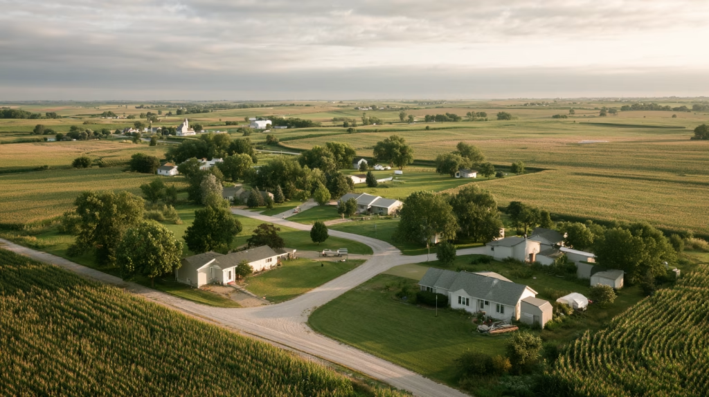
Development proposals tend to arrive one parcel at a time. So do the public decisions attached to them.
A landowner wants to sell. The ground is outside town but close enough to market as a rural homesite. The developer has buyers. The road exists. The property is not in a floodplain. The tax projection looks favorable. In that setting, it is easy to see the question as a simple choice between allowing a reasonable use of private property and standing in the way of growth.
That is rarely the real choice.
The more useful question is whether the community is prepared to accept the permanent public obligations that follow residential development in that location. A new house is not just a house. It is a new address on the road system, a potential school-bus stop, a fire and EMS response location, a snow-removal expectation, a septic or utility-service question, and eventually a voter with understandable expectations about the quality and reliability of public services.
None of those obligations makes growth bad. Communities need housing. Landowners have legitimate interests in the use and value of their property. Counties and municipalities need tax base. Rural places need to keep their families and attract new residents. But growth has a geography, and its public cost changes with location. A home on an infill lot inside an established service area does not impose the same obligation as a home several miles outside town, at the end of a road built for agricultural access and beyond the reach of utilities and routine public services. Twelve houses may fit on forty acres. That does not answer whether that 40 acres is the right place for twelve houses.
This is the fourth and final installment in this month’s series on land use and the comprehensive plan. The first post considered the future land use map: the document that should tell a community, in advance, where it expects growth, conservation, agriculture, and public investment to occur. The second asked what agricultural land use policy protects, including the working ground and public-service capacity that disappear when scattered residential development becomes the default. The third looked at what happens when a zoning regulation works against an adopted plan instead of implementing it.
This piece brings those threads together at the point where they matter most: the vote on an actual development proposal. As with the rest of the series, I am not going to argue from the abstract. I have spent the last several years writing land use and annexation chapters in plans for counties and cities in Colorado, New Mexico, and Nebraska, and the plans themselves are candid about what growth costs and who ends up paying for it. We’ll share some of those today.

The Number on the Table
When a developer brings a proposal to a county board or planning commission, the presentation may include a fiscal impact section. It usually shows projected tax revenue from the development: the assessed value of the homes, multiplied by the local levy, producing an annual figure that sounds like a net gain for the county, city, township, or district.
That number is real. It matters. Local government should not pretend otherwise. What it rarely includes is the other side of the ledger.
Road maintenance on the county road serving the development, calculated over a twenty-year pavement or gravel road lifecycle. School bus route extensions, including driver time, fuel, vehicle wear, and route efficiency. Fire and EMS response: additional calls, longer response distances, and the cumulative effect on staffing, apparatus, mutual aid, and facilities as scattered development pulls coverage in several directions at once. Snow removal on road segments that now serve permanent residential addresses. Administrative costs for permitting, assessment, code enforcement, zoning administration, and subdivision review. Utility extensions if the development eventually connects to municipal water or sewer, or the long-term liability if it does not and the wells and septic systems that serve it begin to fail.
These costs are real. They are predictable. They are almost never all in the presentation.
That is not a criticism of small-town government. It is the reality of development review outside major metro areas, where a county may have one zoning administrator, no engineer on staff, and a planning commission of volunteers who meet once a month when it’s not planting or harvest season.
We talked a bit about that in our first installment this month, “The Future Land Use Map: Your Community’s Most Important Document“. In Thayer County, Nebraska, for example, the same person serves as county zoning administrator, handles zoning review for every village in the county, and acts as county-wide floodplain administrator. Oh, and he’s also the emergency management director. Nobody in that position has time to build a thirty-year fiscal model for a twelve-lot plat, and nobody should expect them to. That is exactly why the fiscal reasoning belongs in the comprehensive plan, adopted once, in public, rather than reinvented for every individual subdivision.
A genuine fiscal impact analysis, one that considers both revenues and public-service costs over the life of the infrastructure involved, tells a more complicated story than a one-page projection of assessed value. The point is not that every rural subdivision loses money immediately or that every new house is a fiscal mistake. People need places to live. The point is that a county board or city council cannot know whether a proposal strengthens the community’s finances if it has been shown only the revenue side of the calculation.
The board is making a thirty-year decision based on a one-year number. Again, that is not a criticism of local boards. It is a description of what they are usually given to work with.
The Plans Already Ask the Question
Here is what encourages me. The small city plans I worked on in New Mexico with Consensus Planning already show how we can write the cost question into policy, and they do it in plain language that any planning commission can apply.
In their land use chapter, the comprehensive plan for the City of Raton sets a goal to expand the city “through annexation of properties that are adjacent to the municipal boundary and can be efficiently served by municipal infrastructure and emergency services,” and attaches an objective that reads like a fiscal impact standard: “To ensure the benefits of annexation outweigh the costs to the City.” The supporting strategy lists the criteria, including “Existing infrastructure capacity” and “Feasibility, cost, and timeliness of extending infrastructure, transportation networks, and public safety services.” The plan identifies four priority annexation areas, roughly 1,250 acres of unincorporated Colfax County, and says each one “will be evaluated based on a cost-benefit analysis to ensure the City of Raton is capable of providing utilities and other municipal infrastructure in a cost efficient manner,” phased “in accordance with the City’s ability to serve those areas.”
In Ruidoso Downs, we used a similar structure. Their plan calls for “an evaluation process for future annexation areas (as shown on the Future Land Use Scenario) that considers the capacity, cost, and benefit of providing infrastructure and public services, in concurrence with property owners,” and states that the two annexation areas on its map “would be annexed once a cost-benefit analysis was completed.” In Bernalillo, our plan suggests the Town develop an annexation policy for property “that can be efficiently served by municipal infrastructure and emergency services” and specifies that the policy “should contain a cost-benefit analysis.” In Aztec, the plan approaches it from the development side, requiring master planning for planned development areas “to ensure there is adequate capacity in the City’s water, sewer, and transportation systems to serve the new development.”
None of those are large places. None of them has a fiscal analysis division. They simply decided, in the plan, that a proposal to extend the city’s obligations has to show its math before it is approved. Every county and municipality can make the same decision.
The Tax Base Argument
New residential development can add value to the tax roll, generate permit fees, support local contractors and suppliers, and in some settings contribute to sales-tax activity. For a small community worried about population loss or housing scarcity, a proposal for new homes carries an understandable sense of opportunity.
The trouble begins when the revenue argument is treated as self-executing: more assessed value must mean more fiscal capacity. We would all like that to be true. It usually is not that simple.
A parcel of agricultural land contributes property tax revenue while demanding very little from the public-service system. It does not require a bus stop, routine residential snow removal, structure fire response, code enforcement, municipal water, streetlights, or a road engineered and maintained for daily passenger traffic. The land’s tax contribution may not be spectacular, but neither is its public-service demand.
A residential subdivision changes that relationship. The new homes generate revenue, but they also create a different and more continuous claim on roads, schools, emergency services, administration, and eventually infrastructure replacement. That is the fiscal question that too often gets skipped: not whether a subdivision creates revenue, but whether the revenue is adequate for the public obligations it creates over time.
The Cost-of-Services Lens
The American Farmland Trust (AFT) Cost of Community Services (COCS) studies offer a useful way to frame the question. As discussed in the second post in this series, “Ag First: How Rural Land Use Policy Protects Working Ground,” these studies compare the revenues generated by existing land use categories with the public expenditures allocated to serve them. They are not project-specific forecasts, and they do not substitute for a full fiscal impact analysis of a proposed subdivision. They are a snapshot of the existing relationship between land uses and local public costs.
AFT explains, COCS studies follow a basic three-step process:
- Collect data on local revenues and expenditures
- Group revenues and expenditures and allocate them to the community’s major land use categories
- Analyze the data an calculate revenue-to-expenditure rations for each land use category.
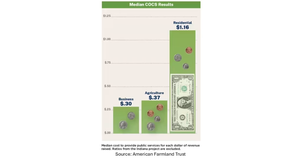
The process is straightforward, and though it takes a bit of work to do the accounting, the COCS approach can be more practical than a specific fiscal impact analysis. Over the decades of study, AFT has found a median cost to provide public services for each dollar of revenue raised varies significantly by land use type:
- $0.30 : $1.00 for Business land use
- $0.37 : $1.00 for Agriculture land use
- $1.16 : $1.00 for Residential land use
For example, a COCS study of Custer County, Colorado, in 2000, found residential uses (including farm houses) cost $1.16 to serve for every $1.00 in public revenue, while commercial and industrial uses cost 71 cents; working and open land cost only 54 cents. In Gallatin County, Montana, where I worked, a 1996 study found residential use cost $1.45 for every $1.00 in revenue, compared to 16 cents for commercial and 25 cents for working lands. I doubt the ratios have changed for the better in the last generation.
The value of this approach is in putting working and open land on equal footing with residential, commercial, and industrial uses in the fiscal conversation. Across the body of AFT work, the repeated finding is not that residential development is inherently undesirable. It is that residential land often requires more in public services than it returns in direct local revenue, while working and open lands frequently generate revenue with relatively modest service demands.
That is a useful corrective to the habit of treating farmland as idle land waiting for a “more productive” use. In a rural county, productive agricultural ground is not vacant simply because it does not have houses on it. It is producing crops, livestock, income, tax revenue, and, in most cases, a lower public-service burden than the residential alternative. Sometimes it is doing public work that nobody has put a price on. Aztec’s plan notes that the Aztec Ditch and Lower Animas Ditch “serve 425 irrigated parcels in Aztec, making up over 107 acres, and reducing the demand for treated water for irrigation purposes.” That is agricultural infrastructure lowering a municipal utility’s costs every summer. Pave over the parcels those ditches serve, and the demand does not disappear. It moves onto the treated system.
The implication is not that a planning commission should reject every homesite proposal. It is that land conversion should be evaluated with more discipline than a single annual tax estimate allows.
Location Determines the Public Cost of Growth
Not all residential development costs the same to serve. That distinction matters, and it is almost never made explicit in the approval process.
A new home built on an infill lot inside city limits, on an existing street, within an established fire district, on a school-bus route that already runs, and near water and sewer capacity: the marginal cost of serving that home can be relatively low. The infrastructure is already there. The services are already calibrated for the density. The new household adds revenue against a service system that is largely already being paid for.
A new home built five miles outside town, on a road not designed for residential traffic, beyond the fire department’s optimal response radius, at the end of a school-bus extension that adds twenty minutes to a route: the marginal cost of serving that home is higher. Services must be extended, expanded, or repositioned to reach it. And when fourteen homes become forty, as additional development follows the pattern set by the first subdivision, those marginal costs compound.
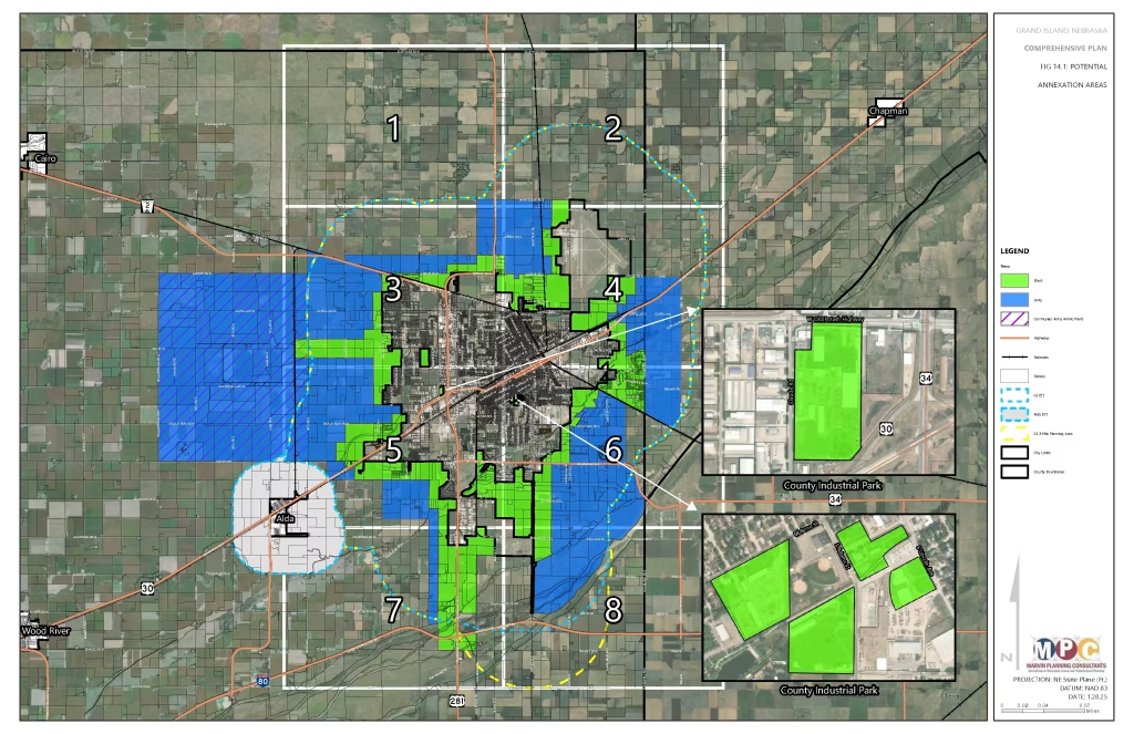
The plans I have worked on build this into the definitions of the map categories themselves. In Grand Island, Nebraska’s future land use chapter we listed “Functional capacity of utilities and public services” among the factors that determine the map, and describes the Agriculture General category as “intended for areas which will not have urban services in the next 20 years.” That is a timing statement as much as a land use statement. It tells a landowner, a developer, and a future council that the city does not intend to extend urban services into that ground during the life of the plan, and that anyone who proposes urban-style development there is asking the public to change course.
The New Mexico plans are just as honest about the other end of the spectrum. In Ruidoso Downs, we described Rural Residential areas as “typically on the edge of the City closer to mountainous forest terrain where building sites may be more constrained and infrastructure is more challenging to construct,” and the future land use scenario shows that category growing from 17.6 percent to 36.0 percent of the city, the largest single category on the map. In Aztec, Rural Residential expands to 25.2 percent of the city, on septic-dependent lots that “must be larger than 0.75 acres.” The numbers are what they are. Mountain towns and river towns grow where the land allows, and many residents want acreage. I raise them because they show why the cost questions have to travel with the map. When the fastest-growing category is also the most expensive to serve, the plan has to say how that growth will be paid for.
This is where “sprawl bad, compact development good” misses the point. The issue is not development for the sake of development. It is location, service capacity, timing, and whether growth occurs where the community has planned to support it. That is a planning argument, not an anti-growth argument, and it is the argument the future land use map is supposed to make before the application arrives.
The Costs That Arrive Later
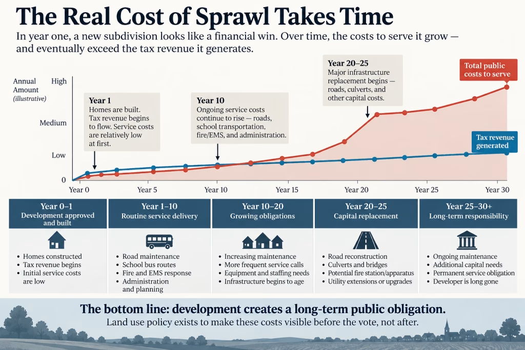
A genuine fiscal review has three ledgers, not one.
The first is familiar: annual revenue. Property tax, applicable sales tax, permit fees, utility charges, and other direct revenues. This is what appears in most development presentations. It is real, and it matters.
The second is annual service costs. Road maintenance and snow removal on the roads serving the development. School bus routes, including driver time, fuel, vehicle depreciation, and the miles required for each additional stop. Fire and EMS runs, considered against the cost of staffing, equipment, travel distance, and response capacity. Administrative costs: assessment, permitting, planning and zoning, code enforcement, and subdivision administration. These costs begin when the first family moves in.
The third is lifecycle and capital costs. This is where the math gets uncomfortable.
The Lifecycle Ledger
Roads are built and maintained around an expected traffic pattern and service life. When residential development adds daily commuting, school buses, delivery vehicles, garbage trucks, construction traffic, and other recurring trips, maintenance schedules and reconstruction timelines can change significantly. When a road segment needs reconstruction, the cost does not arrive incrementally. It arrives as a capital expenditure, often hundreds of thousands of dollars or more, for a road serving a subdivision approved decades earlier.
Keep the scale of rural capital budgets in mind. Thayer County’s One- and Six-Year Road Plan listed four priority projects for 2023: a $175,000 bridge match near Davenport and three culvert projects. That is the scale of capital money a rural county works with in a typical year. A single reconstruction project driven by residential traffic can consume the discretionary capital program for several years.
The same logic applies to culverts and bridges on routes carrying new residential traffic. It applies to fire apparatus if call volume and response distance eventually require repositioning equipment, adding staff, or building a station. It applies to water and sewer infrastructure if a development later seeks connection to municipal systems that were not designed or financed to serve it. It applies to drainage when additional driveways, roadside ditches, culverts, and altered runoff patterns create maintenance needs that did not exist when the land was in production.
The original developer is long gone by then. The county, city, township, district, or utility owns the obligation, and state law often decides which one.
Nebraska offers two examples that should be familiar with most planners and local officials in the Cornhusker State. The first involves roads. Both the Kimball and Burwell annexation chapters quote the statute directly: “any part of a county road shall be deemed to have annexed, without further action, all of the contiguous or abutting road at the time of such annexation” (Neb. Rev. Stat. § 17-405.1). When a city annexes a subdivision along a county road, the road comes with it. The county’s maintenance problem becomes the city’s maintenance problem on the day the ordinance passes.
The second involves Sanitary and Improvement Districts. Under Nebraska law, a majority of the owners of land within a proposed district can petition the district court to form an SID (Neb. Rev. Stat. § 31-727). The district can then install sewer and water systems, streets, sidewalks, street lighting, and other public improvements, financing the work with its own debt and repaying it through property taxes and special assessments levied within the district. SIDs are most familiar on the fringes of Nebraska’s larger cities, where they allow subdivisions to be built before the city is ready to extend its own infrastructure. Yet the obligation does not stay with the district forever. When a city or village annexes all of the territory within an SID, the statute provides that the district “shall merge with the city or village,” and that the city or village “shall be liable for and recognize, assume, and carry out all valid contracts and obligations of the district” (Neb. Rev. Stat. § 31-763). If only part of a district is annexed, the city and the district may agree on an equitable division of assets, liabilities, and maintenance, subject to approval by the district court; if they cannot agree, the court makes the adjustment (§ 31-766). Either way, the streets and pipes arrive on the city’s books along with whatever debt remains on them.
Our plans for the cities of Kimball and Burwell both advise the City to “establish provisions for subdivision improvement agreements and non-contested annexation agreements with any future Sanitary Improvement Districts (SIDs),” which “assures the City the SID can be annexed at such time as it becomes necessary, without the SID contesting the action.” Burwell’s plan adds a telling line: “At this time, no SIDs have been identified in Garfield County.” That is exactly the right time to adopt the agreement template, before the first one is formed and before anyone has a financial stake in the terms.
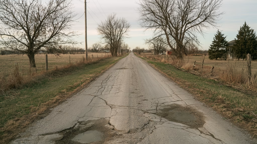
Year one looks fine. Year ten is manageable. Year twenty-five is when the highway superintendent puts a road segment on the capital improvement list and the board asks how it got there.
The Strong Towns Warning
My friends at Strong Towns have given this pattern a deliberately provocative name: the growth “Ponzi scheme.” The phrase is worth using carefully. It describes a cash-flow pattern in which a community receives an immediate benefit from new development, including permit fees, construction activity, increased assessed value, utility connection charges, and short-term revenue, while accepting long-term obligations for roads, pipes, and services that do not fully come due for decades.
The concern is not that all new development is financially unsound. It is that a development pattern dependent on continual outward expansion can conceal its future maintenance burden. New growth generates the revenue and fees needed to help manage the obligations of earlier growth, while the stock of aging infrastructure expands behind it. Eventually the community faces a large inventory of roads, utilities, and public facilities that must be repaired or replaced without a corresponding stream of new development to defer the cost again.
The pattern is often discussed in suburban terms, but rural counties and small towns recognize the same sequence in a different form. It may not be a cul-de-sac with curbs, gutters, and miles of water main. It may be a series of rural homesites on county or township roads, each individually small and seemingly manageable, spread over enough distance that the road system, school transportation network, fire coverage area, and administrative workload become more expensive to operate.
The scale is different. The underlying question is the same: does the public revenue associated with this development pattern cover its long-term public obligations, or are those obligations being pushed forward for a later board to solve?
A Rural County Does Not Experience Sprawl All at Once
The fiscal argument against scattered rural development is not abstract. It has a geography.
Consider a composite rural county: a county seat of several thousand people, a handful of smaller villages, and a road network built over a century to serve agricultural operations and connect communities. The system was designed for its purpose, moving grain trucks, farm equipment, and the daily traffic of a rural population concentrated in towns.
Over fifteen years, residential subdivisions are approved on agricultural land outside town limits, scattered across the county wherever landowners want to sell and developers see opportunity. None of them individually seems significant. Together, they add hundreds of households to road segments that were not designed for residential traffic.
Road maintenance costs rise. The highway superintendent identifies segments serving residential subdivisions that need reconstruction within the next decade, work that would not have been necessary, or would have been decades away, if traffic had stayed where the infrastructure was built to support it. The volunteer fire department serving the rural area sees call volume rise, with newer residential areas accounting for a growing share of the demand, and response times to the farthest subdivisions drift outside the benchmarks that influence insurance ratings and emergency service performance. The school district adds bus routes that did not exist fifteen years earlier. Those routes serve the scattered subdivisions, and they are the least efficient routes in the district, covering the most miles for the fewest students.
No individual subdivision caused the full outcome. The pattern did.
The county is a composite, but its parts are not hypothetical, and the plans I have worked on describe them in their own words. In Hall County, we listed “Exurban residential growth pressure from the Tri-cities of Grand Island, Hastings, and Kearney” among its defining characteristics, and the plan describes how service expectations change when that pressure arrives: “New development may bring paved roads, security lighting, and other ‘improvements’, while long-term residents dislike increased traffic and car crashes, and inability to see the stars due to light pollution.” Those improvements are not free, and once they exist, someone has to maintain them. In Thayer County, where development pressure is light, about half of survey respondents already disagreed that “County roads are in good condition.” A road system that residents already consider stretched does not have much room to absorb a new residential pattern.
This is why planning commissions and county boards should be cautious about evaluating each rural plat as though it exists in isolation. One approval sets a precedent. Repeated approvals establish a development pattern. The public cost of that pattern is greater than the cost of any single lot line on any single plat.
The Jurisdictional Problem
The bill seldom arrives at one desk. There are plenty of long-term costs to go around.
The County may carry road and development-review responsibilities. The Township may maintain the local road. The school district absorbs the additional route miles. A rural fire district, volunteer department, or EMS provider covers emergency response. A municipality may eventually face pressure to extend water or sewer. The assessor, zoning administrator, county attorney, and clerk each see administrative effects in different forms. Each public entity sees only its part of the demand, and no one may be responsible for adding up the whole cost of a dispersed residential pattern.
The plans I have worked on show how varied, and how fragile, those arrangements can be. In Jefferson County, Nebraska, “County zoning applies up to the municipal limits where villages have chosen not to assert jurisdiction over an ETJ,” and five villages, Daykin, Endicott, Harbine, Reynolds, and Steele City, “are not zoned and therefore have no ETJ.” Grand Island is large enough they have a two-mile extraterritorial jurisdiction, but its plan notes that the city “has not yet extended their Zoning Extra-Territorial Jurisdiction (ETJ) to the full extent of the two-mile area after recent annexations,” so the remaining portion of its planning area falls under Hall County. In Raton, New Mexico, the extraterritorial zoning area around the city “is administered by the Raton Fire Department,” and “Colfax County otherwise has not adopted zoning regulations.” Each of those arrangements is workable. None of them is automatic. Every one depends on somebody paying attention to where one jurisdiction’s responsibility ends and the next one begins.
In many cases, plans build a place for that attention to happen. Clay County runs development review through a Joint Planning Commission that “includes representatives of unincorporated Clay County, the cities of Fairfield and Harvard, and the villages of Deweese, Glenvil, Saronville, and Trumbull,” and the county zoning administrator serves the towns as well. In Thayer County, we included policies for the zoning administrator to “continue to monitor annexations, and make sure the Joint Planning Commission is involved in review and update of municipal boundaries, extra-territorial jurisdiction, and zoning.” Hall County, Grand Island, and four smaller communities have shared the Hall County Regional Planning Commission since an interlocal agreement in 1967. Grand Island’s plan also reaches past general-purpose government altogether, with actions to “Work with other units of government on facilities siting” and to “Work with public school districts on long-term facilities siting.” School buses follow houses, and schools follow buses. A land use plan that never talks to the school district is missing one of the largest public-cost decisions in the community.
That is why city-county coordination, extraterritorial planning, and clear service-area policies matter. It is also why a comprehensive plan should not stop at a generalized statement about orderly growth. It should identify where development is expected, where it is premature, what infrastructure must be in place, who will provide it, and how the public cost will be assigned.

Ask Before You Approve
A planning commission does not need a graduate-level fiscal model to ask better questions. It needs a habit of asking them before approval, not after the maintenance backlog appears. And in most of the communities I have worked with, the plan already supplies the language to ask them with.
Five Questions Before the Next Subdivision
Before the next subdivision plat reaches a vote, five questions belong on the table.
1. What new annual revenue will this development generate?
Property tax, fees, applicable sales tax, and utility revenue should be calculated openly. This is usually the only number in the room. It should be the starting point, not the conclusion. And it should be calculated honestly on both sides: Hall County’s plan says rural development should “Not be justified solely or even primarily, on the argument the land is less costly than alternative sites.” Cheap land lowers the developer’s costs. It does not lower the public’s.
2. What services must be extended or expanded to serve it?
Roads, school transportation, fire and EMS coverage, snow removal, planning and zoning administration, law enforcement, and utility capacity should be identified. If the answer is “none,” because the development is inside an existing service area and uses existing capacity, that is relevant information. If the answer is “several,” that is relevant too. Hall County’s criteria for rural development are a good model because they are specific enough to check: the site must “Have adequate access, including a minimum of two entrances/exits” and “Have adequate individual or community water supply and wastewater treatment.” A second access point is not a design nicety. It is how a fire truck gets in when the first road is blocked.
3. What infrastructure will eventually require public maintenance or replacement?
Road segments, culverts, bridges, drainage facilities, turn lanes, water lines, sewer extensions, and emergency-service capacity do not disappear from the balance sheet because an initial developer installed part of the system. The public agency needs to identify the lifecycle of the infrastructure and who will pay when it reaches the end of that life. Nearly every Nebraska plan I have worked on carries the same policy, in nearly the same words: “Developers are prepared to pay the cost of necessary and required on-site and off-site improvements.” The word to watch is off-site. The street inside the subdivision is the easy part. The culvert downstream, the turn lane at the county road, and the water main extension and documentation of that nexus are where public costs hide.
4. What does the obligation look like over twenty or thirty years?
The approval stage does not require a perfect engineering estimate for every future cost. It does require an honest acknowledgment that an approval creates a long-term obligation, not merely a short-term revenue gain. Where the likely burden is material, a more detailed fiscal analysis may be appropriate before a decision is made. The plans can help here too. The implementation tables in the Burwell and Grand Island plans, for example, sort each land use action into time bands (less than a year, one to five years, five to ten, ten to twenty, and ongoing), identify responsible organizations and funding sources ranging from general funds and bonding to TIF, grants, sales tax, and developers, and flag the actions that belong in the capital improvement program. That column is a small thing with a big implication: it tells the governing body which land use policies carry a price tag, before anyone approves the project that triggers it.
5. Is this where the comprehensive plan says growth should occur?
If yes, the proposal is consistent with the community’s adopted long-range framework, and the central questions become sequencing, capacity, design, and cost allocation. If no, the first four questions carry different weight, because the community is being asked to extend public obligations into an area it did not plan to serve. Hall County and Grand Island both state that “Zoning regulations and the zoning map must be consistent with the Future Land Use Map in this plan.” Where that requirement exists, the fifth question is not a matter of opinion. It is a matter of reading the map.
None of these questions requires a consultant in every case. They require a planning commission who have read the comprehensive plan, staff who can assemble the relevant information, and a governing board who expects the full picture before they vote.
From Plan Policy to Zoning Rules
The third post in this series, “When the Zoning Code Works Against the Plan,” made a simple point: a comprehensive plan can describe the future a community wants, but zoning and subdivision regulations determine what can be approved in the real world.
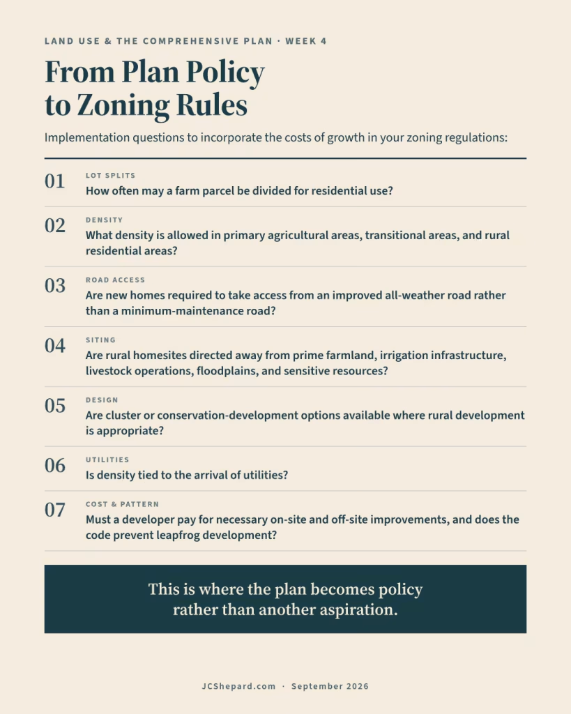
That is especially important at the rural edge. A County may designate an area for agricultural preservation, agricultural production, agricultural transition, or rural residential use on its future land use map. Those labels matter, but they are not self-executing. The zoning ordinance and subdivision regulations determine whether the policy is real. The implementation questions are practical, and the plans I have worked to answer each of them with a number or a rule:
- How often may a farm parcel be divided for residential use? Clay County’s agricultural zoning provides that an “Existing farmstead of 3-acres or more, not previously subdivided prior to adoption of zoning (2005), may be subdivided into two parcels.” Hall County provides that “In specific situations, an 80+ acre tract may be split once for a single-family dwelling site.” Your state statutes will vary.
- What density is allowed in primary agricultural areas, transitional areas, and rural residential areas? Jefferson County steps from two dwellings per quarter section in Agricultural Production to four in Agricultural Highway to eight in Agricultural Transition. Clay County’s zoning adds a “1,000 foot minimum distance between dwellings located in the same quarter section.”
- Are new homes required to take access from an improved all-weather road rather than a minimum-maintenance road? Jefferson County: “Dwellings shall be adjacent to improved all-weather roads (above minimum maintenance road).” Thayer County: “New homes should have access to an existing public road, other than a roadway designated by the Thayer County Board of Commissioners as a minimum maintenance road or other unimproved roadway.”
- Are rural homesites directed away from prime farmland, irrigation infrastructure, livestock operations, floodplains, and sensitive resources? Hall County limits residential development “to agricultural housing in prime farmland areas.” Thayer County adds that “New parcels should not impact ability to irrigate remainder ag land.”
- Are cluster or conservation-development options available where rural development is appropriate? Hall County describes density bonuses in which “a developer may be able to build twice as many homes as typical zoning would allow if they conserve substantial open space or prime farmland,” and lists “Lower costs of infrastructure” among the benefits.
- Is density tied to the arrival of utilities? Clay and Jefferson counties both limit residential density in their historic unincorporated townsites “to legal lots existing at the time of adoption of zoning, until and unless community water and sewer service is provided.” Raton’s R-HZ Rural Holding Zone “is intended for areas to be developed when municipal water and sanitary sewer service can be extended,” allows agriculture and ranching in the meantime, and has its permitted uses reviewed every five years. Both are forms of the same principle: density follows infrastructure, not the other way around.
- Must a developer pay for necessary on-site and off-site improvements, and does the code prevent leapfrog development patterns? Our Nebraska plans pair the developer-pays policy with a second one: “New development should be contiguous to existing developed areas, and avoid ‘leapfrog’ patterns inefficient for public services.”
This is where the plan becomes policy rather than another aspiration.
A future land use map that designates productive ground for long-term agriculture, paired with zoning that allows frequent residential splits and subdivision rules that require little more than a survey and a driveway permit, is not protecting agricultural land or managing public cost. It is describing a landscape that the regulations are steadily dismantling.
Conversely, a plan that directs growth toward municipalities and planned transition areas, paired with standards for density, access, infrastructure, cost allocation, and conservation design, gives elected officials a defensible basis to distinguish between development that strengthens the community and development that merely adds addresses to its service map.

Counties and Cities Share the Central Question
For county leaders, the central question is whether scattered development outside established service areas should be approved at all, and whether the community has the policy foundation to say no when the answer is no. The Nebraska county plans I have worked on answer part of that question by stating a preference. Clay, Jefferson, and Thayer each commit to “Support annexation by cities and villages to minimize the County’s cost of public services,” and Hall County adds that “New development in the county jurisdiction should not compete with municipalities in regard to density or new urban services.” That is a county saying, in writing, that it would rather see a new house inside a village than five miles outside one, and giving a public-cost reason for the preference.
For municipalities, the same fiscal problem often arrives under a different label: annexation.
Annexation extends municipal boundaries and, with them, municipal services: water, sewer, police, fire, code enforcement, street maintenance, and sometimes parks and other facilities. It can also extend the tax base. In Nebraska, it can affect state aid as well; the Kimball and Burwell plans both walk through the documentation a city must file with the Department of Revenue so the state can certify the new population after a boundary change. In theory, annexation should occur when service extension is financially sustainable and when the area is consistent with the municipality’s plan for long-range growth.
In practice, annexation decisions can be driven by political pressure, developer interest, or the concern that if a municipality does not annex a developing area, the county will permit development there under different standards. The result can be a familiar pattern: service infrastructure extends into areas the budget cannot comfortably support, driven by development pressure rather than a deliberate decision about where the community’s growth boundary should be.
The plans I have worked on try to replace pressure with sequence. The Nebraska annexation chapters distinguish near-term areas, to be considered “within the next one to five (1-5) years,” from long-term areas to be annexed “five or more years from plan adoption, or when developed.” Burwell’s plan identifies who belongs in the first group: “Property using city streets for access should be considered for near-term annexation, as they are already utilizing city services,” along with “Areas for which water and sewer, or municipal power, could be easily extended.” Both plans remind the council that “Annexation DOES NOT commit the City to extend services in the near term” and that state law requires a plan for how services will be provided within one year. And Burwell draws the outer line: “Agricultural lands which are ‘rural in character’ are not eligible for annexation.”
The New Mexico plans get to the same place through a different statutory framework. Bernalillo’s plan states that “Areas to be considered for annexation must be contiguous with the municipal boundary and the municipality must be able to demonstrate the ability to provide services,” and records the town’s choice to respond to owner requests rather than chase annexation. Ruidoso Downs maintains a policy that annexation “shall not impose an economic burden on the City or result in an indirect subsidy of services by the City.” Raton’s plan notes that “the Colfax County Comprehensive Plan also favors growth east of the City’s current boundary,” the kind of city-county alignment that makes an annexation program defensible before any particular parcel is on the agenda.
The comprehensive plan is supposed to answer the annexation question before the pressure arrives. Where does the municipality intend to grow? Where should service infrastructure eventually reach? Where should the boundary hold? What land should remain in agricultural production or rural use? What improvements must be financed before annexation or urban-density development proceeds?
A city that has answered those questions in a public process, and adopted a future land use map, growth framework, and implementation standards that reflect the answers, has something to stand on when a developer asks for annexation of a parcel that does not align with the plan. A city that has not done that work is deciding by not deciding, and that is not fair to the landowner, the developer, or the taxpayers who will inherit the result.
The Alternative: Town-Centered, Service-Aware Growth
The alternative to scattered rural development is not NO development. It is growth directed to places already built, or deliberately planned, to support it.
That can mean infill lots inside a city or village. It can mean redevelopment of underused blocks, upper-floor housing downtown, a planned neighborhood adjacent to existing water and sewer, or carefully phased expansion where a city has identified the capacity, financing, and service plan needed to support it. It can also mean conservation development in a limited rural setting, where clustering homes protects working ground, reduces infrastructure needs, and avoids the strip pattern of driveways along a county road.
Burwell’s plan shows how practical this can get. The city’s zoning set a minimum lot area of 6,000 square feet and a 60-foot lot width, and most lots in town were platted at or above that size. The plan suggests reducing the minimum to 5,000 square feet and 50 feet, and it backs the recommendation with a lot-by-lot analysis showing that existing lots over 10,000 square feet would become “theoretically eligible for a lot split at a reduced minimum.” As the plan puts it, “Reducing the minimum lot size and width would not introduce radical changes in the existing development pattern, yet may grant a lot of flexibility to individual development projects.”
Add accessory dwelling units, which we described as “places for young adults to spread their wings close to home, or for grandparents to maintain independence while also staying close to family,” and a small town can create new housing on streets it already plows, along water and sewer lines it already maintains, on a bus route that already runs. The Burwell plan pairs that with an action to “Work with developers and property owners to identify areas with infrastructure capacity, including electricity, water and sewer, and streets.” That is service-aware growth in its simplest form: find the capacity first, then direct development to it.
Grand Island takes the same idea to a larger scale, with a policy that “Priority areas shall be identified and incentives established for infill and redevelopment.” Bernalillo, among the fastest-growing municipalities in New Mexico at the time, concluded that “new growth and development will mostly be accommodated within the existing Town limits through infill.” Aztec states the fiscal logic in one sentence: “Another advantage of infill development is better utilization of existing infrastructure, such as roads, water, and sewer systems, in a more efficient development pattern.”
The common principle is not a particular development form. It is public-service discipline.
Development in and around a municipality, where water, sewer, fire, school service, roads, and civic infrastructure are already calibrated for residential density, typically has a different fiscal profile from scattered development across agricultural land. Agricultural land outside a growth boundary can remain in production, generate tax revenue, and place comparatively little demand on public services. That is why town-centered growth is not anti-growth. It is an argument for growing where a community can afford to grow.
Plan Now or Pay Later
A dozen lots. The heirs wanted out. The developer saw opportunity. The planning commission said yes.
Fourteen lots, eventually. A road showing wear. Eleven fire runs. A school-bus route that did not exist before.
Nobody ran the numbers. Few do, until the cost is already baked into the county’s budget, the development pattern is already on the ground, and the future land use map that said “agricultural” has become a document describing what used to be there.
It does not have to go that way, and the plans I have worked on are proof. A small New Mexico city can write “ensure the benefits of annexation outweigh the costs” into its land use goals. A Nebraska county can adopt a policy that rural development should not be justified by cheap land alone. A town of Burwell’s size can map its own lots to find housing capacity on streets it already maintains. None of that requires a large staff or a sophisticated model. It requires deciding, in advance and in public, that the cost of growth is part of the question.
Land use policy exists to make those costs visible before the vote, not after. The future land use map, the agricultural land use framework, the zoning code aligned with the comprehensive plan: all of it is designed to put the right question on the table at the right moment. Not just can we approve this, but should we, and what will it cost us if we do?
That question, asked consistently, is what separates a community that plans from a community that reacts.
Checklist question for this week: Does your comprehensive plan define where growth belongs, and does it make the cost case for keeping it there?
Coming up in October : Transportation, where infrastructure investment trumps land use, and what it costs when they do not align.
John C. Shepard, AICP, is a planner and economic development practitioner with more than thirty years in public-sector and consulting practice, and serves on the executive committee of the American Planning Association’s Small Town and Rural Planning Division. The views expressed here are his own.
September 2026 — Land Use
- Week 1 — The Future Land Use Map: Your Community’s Most Important Document
- Week 2 — Ag First: How Rural Land Use Policy Protects Working Ground
- Week 3 — When the Zoning Code Works Against the Plan
- Week 4 — Growth Has a Price: Who Pays When Development Sprawls? (this article)
- Bonus Article — Does Your Land Use Plan Actually Work? (in progress)

Further Reading
Tools & Data
- Smart Growth America — Fiscal Impact Analysis — Guidance on conducting genuine fiscal impact analyses that account for service costs, not just revenue projections.
- American Farmland Trust — Cost of Community Services — The essential data source for comparing the fiscal return of agricultural land versus residential development.
Reports & Research
- USDA ERS — Rural Infrastructure and Service Costs — Research on the relationship between rural development patterns and the cost of public services.
- TCRP Reports — Costs of Sprawl-2000 — This comprehensive study, prepared for the Transportation Research Board, calculated the costs of sprawl over a 25-year future from 2000 to 2025 for the 3,091 counties in the United States.
Planning Guidance
- “The unbearable costs of sprawl” — Congress for the New Urbanism policy white paper (2011) exploring the challenges and opportunities or sprawl, the roadblocks of pursuing denser development, and policy tools for promoting density. It also connects suburban sprawl to the global financial crisis of 2008.
- Fiscal Impact Analysis: Methodologies for Planners (PAS Report 561) — L. Carson Bise (2010) report from APA introduces planners to fiscal impact analysis.
- “Fiscal Impact Analysis: Methods, Cases, and Intellectual Debate” — Zenia Kotval and John Mullin (2007) provide a comprehensive description and assessment of methods for estimating fiscal impacts.
Books
- Strong Towns: A Bottom-Up Revolution to Rebuild American Prosperity by Charles L. Marohn, Jr. (Wiley, 2019)
Chuck makes the fiscal case for incrementalism, maintenance over expansion, compact development—in a voice that lands with the decision-makers who most need to hear it. The first of three books so far from Strong Towns, with a fourth (on economic development) promised for next year. - Costs of Sprawl by Reid Ewing and Shima Hamidi (Routledge, 2017)
A survey of urban form and quality of life issues, including public health concerns, tied to development patterns across the US. - Sprawl Costs: Economic Impacts of Unchecked Development by Robert Burchell et al. (Island Press, 2005)
The definitive research volume on the fiscal consequences of scattered development patterns. - The High Cost of Free Parking by Donald Shoup (Routledge, 2017)
While focused on parking, Shoup’s analysis of hidden infrastructure subsidies is directly relevant to how rural counties underestimate the cost of serving scattered development. - Design with Nature (25th anniversary edition) by Ian McHarg (John Wiley & Sons, 1995)
McHarg’s 1969 book is a foundational treatise on ecological planning and landscape architecture. The 25th anniversary edition presents a visionary and practical approach to creating sustainable, healthy landscapes. Our September 2026 book of the month and a Planetizen Top 20 All-Time Planning Book.
Some links above may be affiliate links. As an Amazon Associate, JCShepard.com earns from qualifying purchases.
Resources
Rural-Ready Engagement: Practical Tools for Small Town Planners
 Watch the full replay: youtube.com/@Engaging-Communities (February 2026)
Community engagement can look very different in small towns and rural communities. This webcast was co-sponsored by the APA Community Engagement Interest Group and the Small Town & Rural Planning Division.
Dynamic Decisions Podcast (Season 2 Episode 15)
“Stop Chasing Smokestacks. Grow What You Have” with Teasha Cable of cModel Data, now playing on Youtube (audio), Apple Podcasts, Spotify (May 2026). Other listening links here.
The Rural Impact Podcast (Episode #86)
“Pathways to Powering Rural America” My guest spot on Michelle Rathman’s podcast. Episode page here, listen on Apple Podcasts or Spotify, or watch (!) on youtube. We talked about energy, data centers, and good governance, plus so much more.
Popular posts on JCShepard.com
- The Planning Process—From Vision to Action in Small Towns and Rural America (January 2026)
- Historic Preservation and Rural Economic Development: A Rural Growth Strategy (April 2026)
- Small Towns Can Build a Strong Outdoor Economy Without Selling Out (June 2026)
- The Rise of Rural Entrepreneurship: Building Economies from the Ground Up (January 2026 on Medium.com)
- Reviving Rural America: Why Heritage Tourism Is a Game-Changer Now (September 2025)
- Main Street America and the Revival of Downtown (June 2026)
- What is Economic Development in Modern America? A Field Guide for Small Towns and Rural Places (March 2026)
- When the Zoning Code Works Against the Plan (September 2026—just this week!)
- Rethinking the Rural Economy: New Paths, New Possibilities for Growth (August 2025)
- How Small Towns Succeed: A Proven Playbook for Rural Action (November 2025)
- Reviving Rural America: Why Heritage Tourism Is a Game-Changer Now (September 2025)
- Is Rural Really the Same as Non-Metro? (February 2026)
- Rural Housing Supply Crisis: Why Small Towns Are Running Out of Homes (February 2026)
- Revitalizing Main Street the Idea-Friendly Way (August 2026 on Medium.com)
- The Rural Comeback: How Small Town Innovation Sparks Growth (August 2025)
- Small Towns, Big Impact: How Rural Communities Are Designing Their Own Futures (November 2025)
- Stop Chasing Smokestacks: A Practical Guide to Small‑Town Economic Development (May 2026)
Check out The 12 Planning & Sustainability Books You Need in 2026 and browse through the Small Town & Rural Community guides on our Resources page.
.