

Part 2 of 4 in our July series on Natural Resources and the Comprehensive Plan.
Nearly every comprehensive plan acknowledges water resources. Very few actually put those resources to work.
The natural resources chapter notes the major rivers and aquifers. The land use chapter maps the floodplain. Somewhere between housing goals and the transportation section, the connection between land use decisions and water quality gets lost. Development happens. Runoff increases. Wells get contaminated. Streambanks erode. And then the county spends years trying to fix problems that were entirely predictable—and largely preventable—at the planning stage.
For small-town leaders, county board members, and planning commissioners, this is not an abstract environmental argument. It is a practical one. Water affects whether a subdivision can be served safely, whether a rural family can trust the well out back, whether flood damages keep recurring, and whether utilities and landowners end up paying later for decisions that looked harmless at the time. The comprehensive plan is one of the few places where those choices can be connected before they become expensive problems.
Water does not respect parcel boundaries. It flows downhill, percolates through soil, and carries whatever is on the surface with it. Every zoning decision, every subdivision approval, every factory and every road laid across a watershed is a water management decision, whether it is treated as one or not.
In June, we discussed utilities and how water gets from source to treatment to your tap. This week we’re going to take a closer look at our sources of water — surface water and groundwater — and how they relate to land use and the comprehensive plan.

Water Is a Land Use Issue
The relationship between land use and water quantity and quality is not a hypothesis. It is one of the most well-documented patterns in environmental planning.
In June, we talked about surface‑water and groundwater systems and source water protection. Today, let’s look more specifically at the relation of water supply and land use in our local plans and policies.
Rivers, streams, lakes, and reservoirs should be identified and mapped alongside watershed boundaries and major drainage corridors. Floodplain maps are the minimum; watershed boundaries and riparian systems provide the actual context for how water moves across the landscape. A drainage basin may cross multiple jurisdictions, and what happens at the top of the watershed affects everything downstream.
Comprehensive plans I’ve worked on here in Nebraska and across the region show how that inventory can be done in a way that actually informs planning. The Jefferson County, Nebraska, plan does not just mention the Little Blue River in passing; we specifically identified the Little Blue, Rose Creek, Big Sandy Creek, Swan Creek, Cub Creek, and Big Indian Creek as part of a connected drainage system across the county. The Hall County Comprehensive Plan maps an even more complex geography, noting that most of the county lies in the Platte watershed, while the northwest corner reaches the Loup and the southeast corner touches the Big Blue. That is exactly the point: county lines and watershed lines are not the same thing, and a plan that ignores that fact is already missing the geography that matters most.
Groundwater deserves the same level of attention, even though it is less visible. Plans should summarize known aquifers, wellfields, and recharge areas, and reference existing Natural Resources District (NRD) water management plans and source water data from local providers—particularly where land use decisions affect long-term treatment costs and supply reliability.
Nebraska’s Natural Resources Districts (NRDs) are a unique system of local government. Instead of drawing borders around county lines, Nebraska divides itself into 23 districts based on major river basins. Governed by locally elected boards, they are primarily funded by local property taxes to manage soil, water, and forests on a watershed basis. They are sort of like supersized Soil & Water Conservation Districts (SWCDs).
We can look at several practical examples in county comprehensive plans I’ve worked on recently. Our Clay County, Nebraska, plan notes that groundwater is the main source of water for irrigation and municipal use, reports depth to water table generally between 60 and 100 feet, and acknowledges that in some areas pumping has exceeded recharge. The Jefferson County Comprehensive Plan distinguishes between shallow wells with lower yields, deeper wells with higher mineral content in some locations, and documented declines in drinking water well levels around the county seat of Fairbury over the last decade. (Fairbury just this week adopted emergency water restrictions due to ongoing drought conditions.) The Hall County plan describes water-bearing sands and gravels that can support irrigation wells pumping more than 1,000 gallons per minute, while also noting concerns about high nitrate content and aquifer depletion already addressed in the Central Platte NRD’s groundwater management plan.
Nebraska’s NRDs are a useful reminder that hydrology already has a regional governance structure, even when land use still tends to be handled parcel by parcel. Clay County is split between the Little Blue NRD and the Upper Big Blue NRD. Jefferson County spans the Little Blue and Lower Big Blue NRDs. Hall County works through the Central Platte NRD, whose master plan covers groundwater-surface water supply, water quality, flood prevention, and drought mitigation across eleven counties. If comprehensive plans ignore those basin-scale systems, local decisions will continue to operate out of sync with the actual geography of water.
The information already exists. The question is whether the comprehensive plan is using it in a way that informs decisions.
Where our earlier article here on rural water systems focused on treatment, distribution, and utility service, this is the upstream side of the same system—the landscape processes that determine whether water remains clean, abundant, and affordable to access and treat. Every land use decision is a water management decision. The question is whether local governments are making it consciously.
Every land use decision is a water management decision. The question is whether local governments are making it consciously.
Linking Land Use to Water Quality
Impervious surfaces—rooftops, parking lots, roads—increase runoff velocity and volume, reducing the time water spends on the landscape before reaching streams. That means less infiltration, less groundwater recharge, higher flood peaks, and more pollutants delivered to waterways in concentrated pulses. A watershed that was 10 percent impervious a generation ago and is now 30 percent impervious behaves like a different watershed entirely.
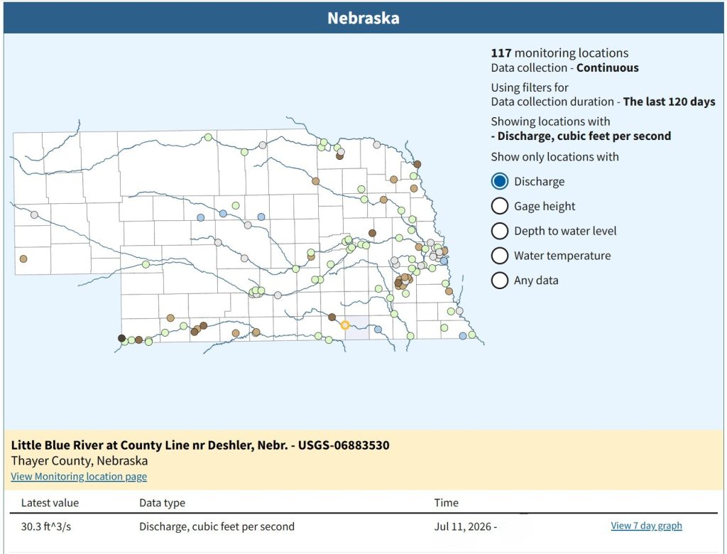
Our Nebraska county plans are useful here not because they repeat the stormwater literature, but because they show how plans can contain the ingredients for that analysis. Jefferson County has access to over 100 years of stream-gauge data near Fairbury and notes a May 2015 peak of 25.48 feet on the Little Blue River, well above major flood stage. Clay County notes a 2019 peak of 19.35 feet on the Little Blue downriver in Thayer County, above the National Weather Service flood stage of 16 feet. Those are not just hazard-mitigation facts. They are reminders that runoff, storage, channel behavior, and land use are connected, even if many plans still leave those connections implicit.

Agricultural and rural land uses introduce their own runoff pathways. Confined animal feeding operations (CAFOs), onsite wastewater treatment systems (OWTS), and runoff from roads, farmyards, and developed sites can all affect waters of the State, triggering permitting requirements, nutrient management obligations, and in some cases Total Maximum Daily Load (TMDL) implementation.
We spent some extra time on the Thayer County, Nebraska, Natural Resources chapter. The text identifies Big Sandy Creek as an impaired water under Section 303(d) of the Clean Water Act, with aquatic life, water supply, and recreation impaired due to atrazine and E. coli. The implementation language tied to that TMDL points directly to nonpoint source programs, NRCS assistance, NPDES waste load allocations, CAFO regulation, and best management practices. Jefferson County makes a similar point by noting impaired waters in the Blue River watershed tied to atrazine and E. coli, with aquatic life, water supply, and recreation already identified as impaired beneficial uses. In other words, the chain from land use to water quality to regulatory response is not theoretical. It is already written into the planning record.
CAFO regulation is one place where that chain becomes especially visible. Land use and zoning ought to align, if we listen to good planning practice and (here in Nebraska anyway) state law. Clay County’s existing zoning already treated medium to large confined feeding operations as conditional uses and included minimum separation requirements from dwellings, schools, churches, and other public uses, as do many counties across the Midwest. Hall County similarly treats larger livestock feeding operations as conditional uses with spacing standards. Jefferson County scales its review process by animal units, with larger facilities moving from administrative review into Planning Commission and County Board review, and with separation distances increasing as facility size increases. Those are land use controls, but they are also water-protection tools, and immediately informed discussions of proposed zoning reform.
The pattern is just as visible outside Nebraska. In Kewaunee County, Wisconsin, for example, a rapid expansion of large dairy CAFOs on a karst landscape—thin soils over fractured bedrock—combined with heavy manure application and irrigation led to significant groundwater contamination in private wells. The geology allowed liquid manure and nutrients to move quickly through sinkholes and fractures into the aquifer, bypassing the slower filtering that more protective soils might have provided. As contamination reports mounted, so did pressure for changes in siting, nutrient management, and land use controls, illustrating in stark terms that decisions about where and how intensive livestock operations locate are water management decisions, even when they are made under the banner of economic development.
Soils and subsurface conditions shape these outcomes. Soil permeability, depth to the water table, and hydrologic soil groups influence both contamination risk and groundwater recharge. Hall County’s chapter is especially helpful here because it explicitly notes that sandy soils in parts of the county raise particular issues for groundwater contamination. Clay County and Jefferson County both tie their soil surveys to development limitations such as flooding, saturation, seepage, shrink-swell, ponding, slow water movement, and septic suitability. A county that knows where the sandy recharge areas are, where the shallow bedrock sits, and where septic limitations are severe already has much of the information it needs to connect land use review to contamination risk.
The comprehensive plan is where that separation ends—or should. If the land use map and the natural resources chapter do not talk to each other, the county will end up relying on utilities, NRDs, and state agencies to clean up problems that were visible much earlier.

Groundwater: What Happens Below the Surface
Surface water is visible. Groundwater is not—which may explain why it receives less attention in most comprehensive plans, despite being the primary drinking water source for many rural households and communities.
This is not a question of how water is delivered—that is the role of utilities—but of how land use determines whether that water remains accessible and usable in the first place. Groundwater protection starts with understanding the aquifer: where recharge occurs, how deep the water table lies, and what pathways allow contamination to move.
Our county plans show different versions of the same reality. Thayer County describes the High Plains Aquifer as producing between 100 and 2,000 gallons per minute there, averaging 800 to 1,200 gpm, and notes a smaller paleovalley aquifer across southern Thayer County and adjacent Jefferson County producing up to 1,200 gallons per minute. Clay County (just northwest of Thayer County) reports similar High Plains Aquifer productivity and notes areas where irrigation withdrawals exceed recharge. Jefferson County distinguishes between thick beds of saturated sand and gravel in the Little Blue and Rose Creek valleys, shallower domestic wells in some bedrock-influenced areas, and deeper wells with higher mineral content in others. Hall County, further northwest of Clay County on the Platte River, describes a countywide basal deposit of sand and gravel, with groundwater near the Platte directly affecting instream flows.
This sort of variation matters because a policy that makes sense in one hydrogeologic setting may be exactly the wrong one somewhere else in the same county. Kewaunee County’s experience underscores the same point from a different landscape. Where fractured carbonate bedrock lies close to the surface, conventional assumptions about manure application and irrigation break down quickly. Practices that might be marginally manageable over deeper, more protective soils can become direct pathways for contamination when the aquifer is only a few fractures away. The lesson is broader than one county in Wisconsin: groundwater risk is not just about the use itself, but about the geology beneath it
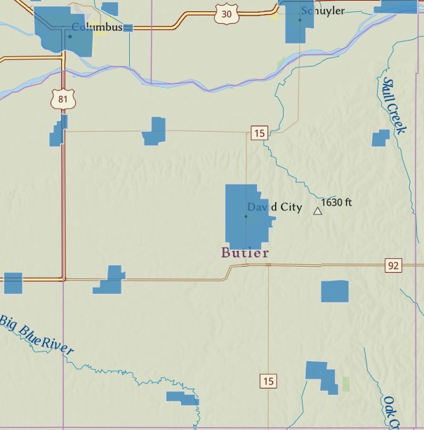
Wellhead protection is the planning tool most directly aimed at this problem. As we noted in June, under the Safe Drinking Water Act, the US EPA works with states to establish programs to identify the areas contributing water to public supply wells and to manage potential contamination sources. What many states do not require is that those delineated areas be brought into local zoning and comprehensive planning in a meaningful way.
Our county chapters illustrate both the opportunity and the gap. Clay County reports eight communities with approved wellhead protection plans and notes that the county has already adopted a Wellhead Protection district in its zoning regulations. Jefferson County lists ten communities with Wellhead Protection Areas (WHPAs) and explicitly states that when a new wellhead protection area is designated, the county should update its comprehensive plan and work with the NRD to protect it. Thayer County identifies nine communities with approved wellhead protection plans and outlines the expected local actions: establish performance standards, participate in contingency planning, and work with state agencies on public information. That is exactly the bridge many plans are missing: moving from “the state has delineated this area” to “the county will actually use this boundary in land use review.”
Utilities may delineate wellhead protection areas, but without corresponding land use controls, we are managing risk rather than preventing it. A wellhead protection area that exists in a state database but has no zoning overlay, land use designation, or subdivision standard attached to it is not protecting much of anything. Hall County’s chapter does not go as far on zoning overlays, but it does frame groundwater quantity and quality as a county goal and ties action items to water providers and OWTS compliance. Clay and Jefferson show the next step more clearly by linking wellhead planning to local implementation.
For rural counties where individual household wells are the norm, the planning challenge is different but equally important. Septic systems, agricultural chemical storage, feedlots, and road runoff all represent potential contamination pathways for private wells. That challenge is visible in the way several of these chapters tie septic limitations and groundwater protection back to soil surveys and lot-size expectations. Soil limitations (covered in last week’s article on soils and the comprehensive plan) are part of the picture — but so is the broader pattern of land use in the area surrounding individual well sites.
Groundwater protection is not only about municipal wellfields. It is also about the cumulative landscape around hundreds of private wells that may never appear on a utility service map.

Policy Frameworks in the Plan
If water is a land use issue, then the comprehensive plan is the place to say so clearly — and to say it in a way that directs decisions.
Plans can move beyond description by establishing goals and policies that explicitly address groundwater quantity and quality, watershed management, and coordination with NRDs and water providers. That means more than general language about “protecting resources.” It means identifying priorities: maintaining aquifer levels, protecting recharge areas, reducing nutrient loading to streams, and managing development within watershed thresholds.
Our county plans show several practical models. Clay County’s natural resources chapter includes a goal that the County “continues to protect groundwater quantity and quality,” then follows it with policies requiring development projects to demonstrate domestic water availability and maintain adequate lot size for well and septic service where urban utilities are unavailable (most of the unincorporated area). Hall County uses a similar structure, with actions to work with water providers on domestic supply and help property owners conform with state OWTS regulations. Jefferson County adds a potentially useful implementation step by calling for work with NDEE and municipalities on Wellhead Protection Plans — we’ll see if local leaders pick up on this or not. More or les, these are not flashy policies, but they are the kind of practical plan language that can actually guide land use review.
The watersheds side is equally important. Clay County states directly that watersheds and surface water are to be properly managed and protected, with action to work with the NRD on implementation of water management plans. Hall County’s plan says much the same thing. Jefferson County goes further by naming both the Little Blue NRD and the Lower Big Blue NRD and assigning county action to implementation of each district’s goals, objectives, and action items. That is a useful model because it recognizes that “coordinate with the NRD” only becomes meaningful when a plan names the actual districts and commits to their existing planning frameworks.
This is where the comprehensive plan can do work that no other document does. It can connect datasets and regulatory frameworks that typically operate in parallel: NRD groundwater management areas, wellhead protection zones, stream-gauge and TMDL data, floodplain maps, soil surveys, and local zoning maps. Without that connection, each system functions in isolation. With it, land use decisions begin to reflect how water actually moves through the landscape.
The plans also show room for stronger policy language. Hall County includes a soil policy stating that development and use of land should include best practices for soil conservation. Thayer County’s impaired-waters discussion explicitly lists implementation of Best Management Practices (BMPs) as part of TMDL water quality response. The Clay, Jefferson, and Hall plans all contain policy scaffolding that could easily be extended to say more clearly that sensitive recharge areas, wellhead protection areas, riparian corridors, and impaired-waters watersheds warrant enhanced standards for development and agricultural operations. The policy move is not complicated. It is simply the difference between saying “water is important” and saying “here is where higher standards apply, and here is how the county will use them.”
Embedding Best Management Practices
Policies should also be specific about how land use will respond to these constraints. Best management practices (BMPs) for both agricultural and developed land are not new, but they are often treated as recommendations rather than requirements. A stronger approach is to identify where they apply and under what conditions they are expected.
Thayer County provides one of the strongest examples because its discussion of impaired waters already links water-quality problems to BMPs, CAFO regulation, nonpoint source programs, and NRCS assistance. Hall County explicitly includes low-impact development practices such as rain gardens, bioretention, permeable pavement, rainwater harvesting, and open-space development as tools to reduce runoff, protect water quality, and improve groundwater recharge. Those examples matter because they move the conversation beyond abstraction. They show that a county plan can talk about buffers and BMPs in one paragraph and actual site-design tools in the next.
The key distinction is between acknowledging BMPs and embedding them in the decision-making framework. A policy that calls for buffers along streams should be paired with subdivision standards. A policy that calls for nutrient management in sensitive groundwater areas should connect to conditional use standards for CAFOs and large livestock facilities. A policy that values recharge should affect how the county evaluates lot splits, rezonings, and infrastructure extensions in those areas. If the plan identifies a risk, it should also identify the mechanism that addresses it.
A wellhead protection area that exists in a state database but has no corresponding zoning overlay or land use designation is not protecting anything. The same is true of watershed goals that are not reflected in how rezonings are evaluated or how infrastructure extensions are approved. The policy framework is only meaningful if it is tied to the tools that shape development on the ground.
That connection—between policy and action—is what turns a comprehensive plan into a water management tool. It is also what sets up the next step: translating these policies into coordinated implementation with the agencies, jurisdictions, and review processes that shape day-to-day decisions.

Implementation and Partnerships
The gap between acknowledging water resources and planning for them is, fundamentally, a process problem. Maps and policies are necessary, but they do not protect anything on their own. Protection happens in the daily work of reviewing projects, applying standards, and coordinating with the people who already manage parts of the water system.
Implementation begins with coordination. The attached plans repeatedly point in the same direction: work with water providers on domestic supply, assist property owners in complying with state OWTS standards, and work with NRDs on implementation of water management plans. In the Clay County plan we said this directly. Hall County reads much the same. In Jefferson County, we added specificity: to work with NDEE and municipalities on Wellhead Protection Plans. What these chapters suggest, taken together, is that coordination does not need to be invented from scratch. The relationships are already named in the plan. What matters is whether counties use them during actual development review.
How to do we put this to work out in the field? For one, when a subdivision, rezoning, or high-impact conditional use comes in, we should highlight in staff reports whether the site lies in a wellhead protection area, near an impaired stream segment, within a mapped floodplain, in soils with severe septic limitations, or inside an NRD management area. Jefferson County’s plan should be especially helpful because it already points to multiple external systems the County could consult: stream gauges, impaired waters, NRD plans, wellhead areas, and utility supply concerns around Fairbury. That is the beginning of an interagency review checklist, whether the plan labels it that way or not.
Land use controls matter just as much. Jefferson County’s pre-existing zoning distinctions for livestock operations by animal-unit scale are a useful example of how review intensity can match potential impact. Clay and Hall Counties both describe the relationship between the Comp Plan and Zoning’s conditional use authority, including how spacing standards can be used to address larger feeding operations before problems show up in a stream or well sample. Those are not merely agricultural land use provisions. They are water-protection mechanisms disguised as zoning details.
Watersheds cross boundaries, and the plans quietly acknowledge that reality. Clay County is split between two NRDs. Jefferson County spans the Little Blue and Lower Big Blue. Hall County lies mostly in the Platte but touches two other major watersheds. That means intergovernmental coordination is not a nice extra. It is built into the geography of the counties themselves. A watershed-scale problem cannot be solved by pretending it stops at the township line or county road.
One useful next step for counties would be to formalize a regular review process with NRD staff, local water providers, road departments, and emergency management. The plans already reference these actors. The practical move is to put them in the room before major land use decisions are made.
Connecting Water to Land Use: Practical Steps
The mechanics of integration are not complicated, but they do require intention. Decisions about where growth occurs ultimately determine how complex—and expensive—the ‘source to tap to treatment’ system becomes.
A water resources map can bring together streams, floodplains, wellhead protection areas, watershed boundaries, impaired waters, and high-risk soils in a single working document. Our plan chapters contain most of these layers. In Jefferson County’s plan, we name major streams, reservoirs, impaired waters, wellhead communities, and flood stages. Clay County combines stream-gauge information, NRD boundaries, groundwater conditions, floodplains, wetlands, and a county zoning wellhead protection district. Hall County adds the multiple-watershed context and specific low-impact development tools; as a larger county, they have more development pressure yet also slightly more implementation capacity. The practical lesson is simple: the maps should not just illustrate the chapter. They should become ongoing tools for staff and boards to make better decisions in real life.
Plans should include clear direction to staff and decision-makers: consult these maps when reviewing rezonings, subdivisions, infrastructure extensions, and conditional uses. Jefferson County’s action items around wellhead plans, impaired waters, wetlands, soils, and agricultural impacts are close to that threshold. Your implementation could become stronger still by explicitly stating these mapped features are review criteria for discretionary decisions. That same strengthening would fit naturally in most community as well as county-level comprehensive plans.
Here is what that looks like in practice:
- Map watersheds, not just floodplains. Jefferson, Clay, and Hall counties all show why this matters by naming multiple streams, tributaries, and basin relationships rather than treating water as a single floodplain overlay.
- Treat impaired waters as land use signals. Thayer’s Big Sandy Creek and Jefferson’s impaired water segments show that TMDLs and water-quality listings should feed back into local review, not sit in a separate regulatory silo.
- Integrate wellhead protection into zoning. Clay County’s existing zoning discussion is a concrete example of how to move from state-level delineation to local land use control.
- Use conditional uses and performance standards for high-impact operations. The CAFO provisions discussed in our county plans show how separation distances, review thresholds, and facility standards can function as water-protection tools when implemented by zoning regulations.
- Use soils and recharge information in lot and siting decisions. Hall County’s sandy-soil caution and the septic and development limitations discussed in several plans show why groundwater protection starts with where things are allowed to go.
- Work through the NRDs and SWCDs already on the map. I may have overdone it in these projects but our plans repeatedly point to NRD water management plans as the regional framework counties should be using. We do better when we work together with experts in the field.
Here’s something to consider: How do we make our plans more useful? How can they be more of a field guide, helping people recognize patterns in the landscape before those patterns become problems. A comprehensive plan can do that. When a rezoning application lands on the agenda, County staff and decisionmakers should be able to look at the map and ask a short list of practical questions: Which watershed is this in? Is the site in or near a wellhead protection area? Are the soils suitable for the proposed use? Does this area already face nitrate, runoff, or flood concerns? Which NRD or water provider needs to be consulted before the decision is made?
If those questions can be answered consistently, water is no longer just a chapter in the plan. It becomes part of the county’s ordinary decision-making.

The Bottom Line
Water is not a background condition for development. It is the resource that makes settlement possible in the first place—and the resource most directly affected by how counties decide to grow.
That is why this issue matters to both planning professionals and small-town leaders. A County board member deciding on a rezoning, a planning commissioner reviewing a subdivision, a planning tech answering questions about a well or septic permit, and a utility manager worrying about treatment costs are all dealing with different parts of the same landscape system. The comprehensive plan is where those pieces can be brought together before the consequences arrive as flood damage, nitrate problems, expensive treatment, or conflict between neighbors.
The practical lesson is not that every county needs a new bureaucracy or a glossy environmental master plan. It is that County leaders should use the information they already have—watersheds, stream gauges, wellhead protection areas, soils data, impaired waters listings, NRD plans, zoning standards—and use it at the moment decisions are made.
Comprehensive plans that treat water and natural resources as a section to be checked off are missing the point. The land use decisions in every other chapter—where housing goes, how roads are laid out, what uses are permitted near streams and recharge areas, how livestock facilities are reviewed, how stormwater is handled—are water management decisions whether local governments acknowledge them or not.
The sooner we start making those decisions consciously, the less we will spend correcting the consequences later.
Next Sunday, July 19th, we move to wetlands: what they are, what they do, and why most counties are underestimating their value in the comprehensive plan. Wetlands aren’t just regulatory obstacles. They store floodwater, recharge groundwater, and buffer communities from the costs of development in the wrong places.
Questions about integrating water resources into your comprehensive plan? Get in touch and I’ll point you towards some resources.
We had a great discussion at the Inland Northwest Partners‘ summer conference in Cheney, Washington, last week, on measuring success on Main Street. I even brought back homework. More on this here soon.
Let me know if I can work with you to present a keynote presentation or workshop on any of the planning and development topics we explore here at JCShepard.com. Next up: the Western Planner Conference in Sioux Falls, South Dakota, the end of August.

FURTHER READING
The water resource data referenced in this article is publicly available and already covers your county. The resources below will help you go deeper — whether you’re looking for watershed data, groundwater protection guidance, or planning frameworks that connect land use decisions to water quality outcomes.
Data Tools
- USGS National Water Information System — Stream flow, water quality, and groundwater data for monitoring stations across the United States. The starting point for any watershed-based planning analysis.
- EPA Watershed Academy — Free training and resources on watershed planning, impervious cover, and land use-water quality connections. Practical and accessible for planning staff.
- USGS StreamStats — Web application for obtaining streamflow statistics, drainage basin characteristics, and other information for ungaged sites. Useful for subdivision and infrastructure review.
Reports & Research
- EPA’s Protecting Water Quality from Urban Runoff — Clear, practical overview of the relationship between impervious cover, urban runoff, and water quality. Essential background for any planner working on stormwater or subdivision standards.
- Wellhead Protection: A Guide for Small Communities (EPA) — Federal guidance on establishing wellhead protection programs and connecting them to local land use planning.
- Center for Watershed Protection — Watershed Planning Resources — The leading nongovernmental resource on watershed planning, impervious cover thresholds, and stormwater management for planners and local governments.
Planning Guidance
- Sustaining Places: Best Practices for Comprehensive Plans (APA PAS Report 578) — APA’s framework for integrating natural systems — including water — into long-range comprehensive planning.
- Growing Greener: Putting Conservation into Local Plans and Ordinances — Randall Arendt’s practical guide to conservation-based planning, with specific attention to riparian buffers, watershed protection, and open space design.
Books
- Cadillac Desert: The American West and Its Disappearing Water — Marc Reisner (Viking Press, 1986). The definitive account of water, land use, and policy in the American West. Essential context for any planner working in the Great Plains or beyond.
- Words on Water: Droplets of Wisdom from Rivers, Lakes, and Oceans — Matthew L. Moseley (CG Sports Publishing, 2026)
- Running Out: In Search of Water on the High Plains — Lucas Bessire (Princeton University Press, 2021). A National Book Award finalist and intimate reckoning with aquifer depletion in America’s heartland.
- River of Lost Souls: the Science, Politics, and Greed Behind the Gold King Mine Disaster — Jonathan P. Thompson (Torrey House Press, 2018) A love story for the Animas River, this compelling read digs into the science, politics, and greed behind the 2015 Gold King Mine disaster at Silverton, Colorado, and the impacts far downstream. Thompson, one of my favorite Western observers, writes on Substack these days, link at LandDesk.org.
This page contains affiliate links. As an Amazon Associate, JCShepard.com earns from qualifying purchases at no additional cost to you. Don’t forget to checkout your local bookshop!
Resources
Rural-Ready Engagement: Practical Tools for Small Town Planners
 Watch the full replay: youtube.com/@Engaging-Communities (February 2026)
Community engagement can look very different in small towns and rural communities. This webcast was co-sponsored by the APA Community Engagement Interest Group and the Small Town & Rural Planning Division.
Dynamic Decisions Podcast (Season 2 Episode 15)
“Stop Chasing Smokestacks. Grow What You Have” with Teasha Cable of cModel Data, now playing on Youtube (audio), Apple Podcasts, Spotify (May 2026). Other listening links here.
The Rural Impact Podcast (Episode #86)
“Pathways to Powering Rural America” My guest spot on Michelle Rathman’s podcast. Episode page here, listen on Apple Podcasts or Spotify, or watch (!!!) on youtube. We talked about energy, data centers, and good governance, plus so much more.
Popular posts on JCShepard.com
- The Planning Process—From Vision to Action in Small Towns and Rural America (January 2026)
- Small Towns Can Build a Strong Outdoor Economy Without Selling Out (June 2026)
- Historic Preservation and Rural Economic Development: A Rural Growth Strategy (April 2026)
- Main Street America and the Revival of Downtown (June 2026)
- Natural Resources in Your Comprehensive Plan (July 2026)
- Reviving Rural America: Why Heritage Tourism Is a Game-Changer Now (September 2025)
- Soils and the Comprehensive Plan: What Your Soil Survey Is Trying to Tell You (July 2026)
- What is Economic Development in Modern America? A Field Guide for Small Towns and Rural Places (March 2026)
- The Rise of Rural Entrepreneurship: Building Economies from the Ground Up (January 2026 on Medium.com)
- Rural Recreation and the Outdoor Economy: Trails, Fairs, Community Identity (May 2026)
- Rural Housing Supply Crisis: Why Small Towns Are Running Out of Homes (February 2026)
- Regenerative Conservation and Community Renewal (June 2026)
- Powering Rural America: The Full Energy Picture in 2026 (June 2026)
- Community Facilities: Why We Need to Rebuild Our Foundations (April 2026)
- Small Towns, Big Impact: How Rural Communities Are Designing Their Own Futures (November 2025)
Check out The 12 Planning & Sustainability Books You Need in 2026 and browse through the Small Town & Rural Community guides on our Resources page.
.


1 Comment
Want to dive into Western water? Here’s a summer reading list from the experts.
Water leaders from around Colorado jumped at the chance to share their favorite reads, ranging from novels to nonfiction and truly dry reads for the real water wonk:
https://coloradosun.com/2026/07/04/western-water-summer-reading-list-from-experts/