October 2026 series: Transportation & the Comprehensive Plan
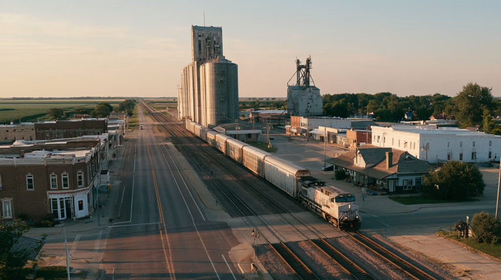
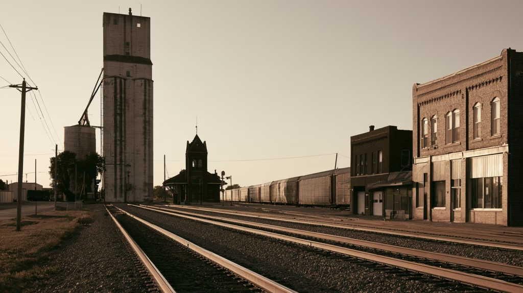
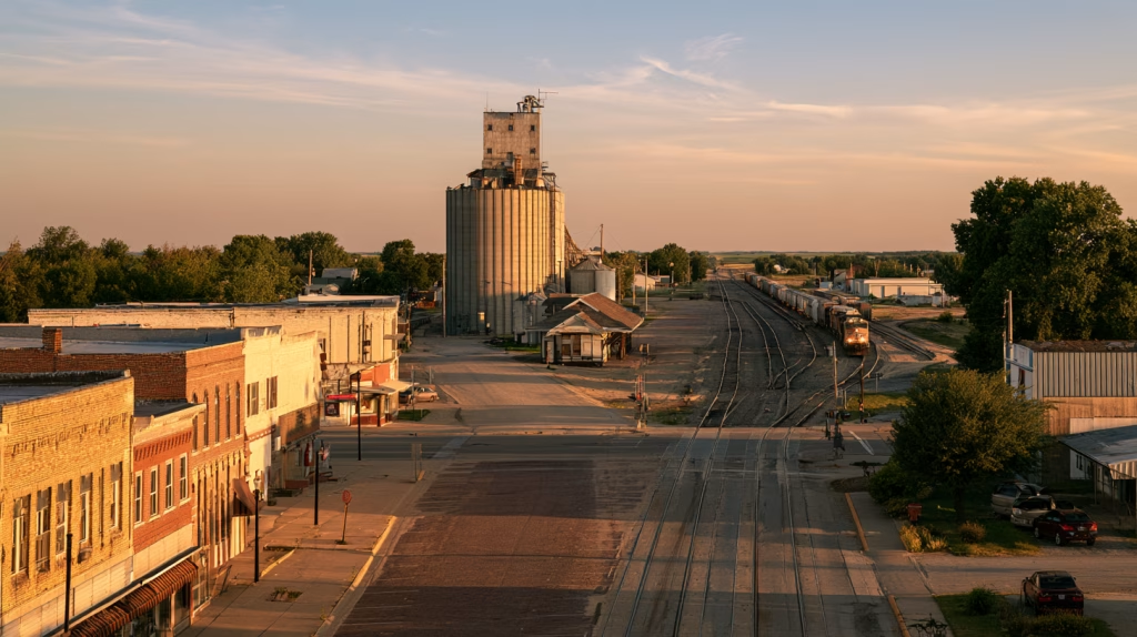
In hundreds of small towns across North America, you can still read the railroad in the street plan. The grain elevator stands beside the tracks. The old depot sits at the end of Main Street, now a museum, an antique shop, or an empty building waiting for a new purpose. The commercial blocks face the railroad because, for much of the town’s history, that was where goods arrived, crops departed, and visitors first stepped into town.
The railroad did more than serve the community. It helped determine where the community would be. That is why any conversation about rail and the rural comprehensive plan has to begin with the street map.
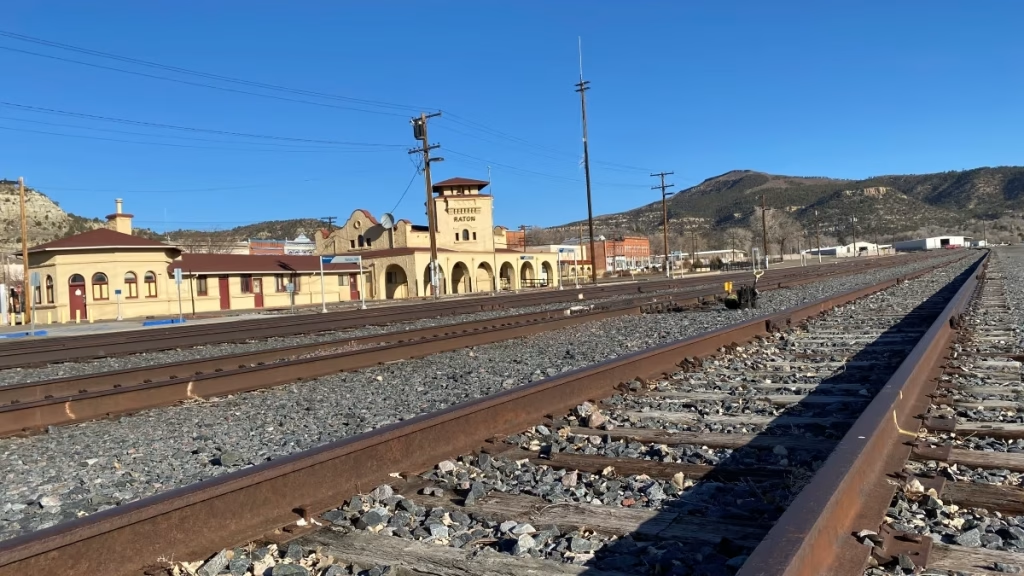
Our 2025 comprehensive plan for the City of Grand Island, Nebraska, says it plainly: the traditional neighborhood grid of streets and sidewalks was “platted parallel to the railroad.” Kimball, Nebraska, grew along the Union Pacific. Raton, New Mexico, laid out its grid along the Santa Fe Railway at the foot of Raton Pass. Drive through almost any county seat across the Midwest or on the Great Plains and you will find the same pattern: a line of elevators, a depot, a commercial district, and a residential grid that takes its bearings from the tracks rather than from the compass.
Today, the trains may still come, but few stop any longer. A mile-long freight train moves slowly through town. The gates at the railroad crossing come down, and traffic collects on both sides: a pickup, a delivery van, a school bus. At night, locomotive horns remind nearby residents that the railroad operates on a schedule of its own.
The railroad built the town; now the town may experience it primarily as an obstacle. Yet the same tracks may remain essential to local industry, regional commerce, or future transportation opportunities. A railroad can be an economic asset and a physical barrier at the same time.
Few infrastructure decisions have consequences as lasting as those involving rail. Rights-of-way established more than a century ago still influence industrial locations, street networks, emergency access, and the direction of future development. That makes rail more than a transportation issue. It is a land-use, economic development, public safety, and long-term investment issue.
Earlier in this series, we looked at how a road’s function should shape the land uses around it, and at how people reach daily destinations when driving is not the only option. Rail brings both of those questions together, with one important difference: most of the key decisions about the railroad are made by someone other than the community through which it runs. This article looks at freight and passenger service, at the crossings where the railroad and the community meet, and at the long-term value of the corridor itself. It closes with what a rural comprehensive plan can realistically do about all three.
The Railroad We Have
Freight Rail: Passing Through or Serving the Town?
Freight rail is one of the less visible foundations of rural economic life. Grain, fertilizer, lumber, building materials, fuel, and other bulk commodities move long distances by rail. For agricultural and manufacturing communities, access to that network can influence transportation costs, business competitiveness, and the viability of local industries.
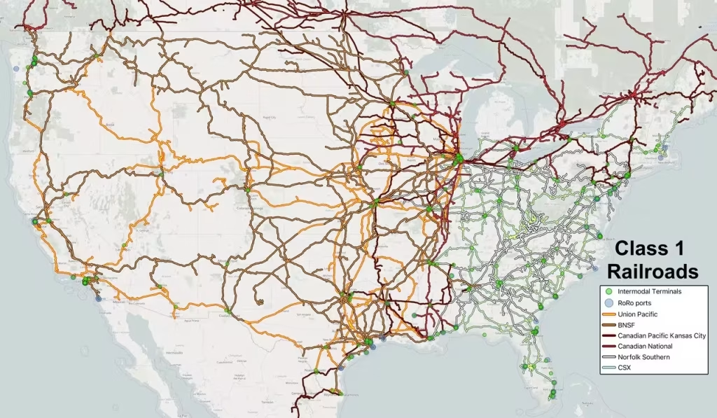
A few large railroads provide most of the long-distance network across North America. Six major freight railroad systems currently operate in the United States and Canada:
- Union Pacific Railroad: 32,700 reported route miles
- BNSF Railway: 32,500 miles
- Canadian National (CN) Railway: 20,000 miles
- Canadian Pacific Kansas City (CPKC): 20,000 miles
- CSX Transportation: 20,000 miles
- Norfolk Southern Railway: 19,200 miles
In many places, though, short line railroads make the local connections. According to the American Short Line and Regional Railroad Association, roughly 600 short line and regional railroads operate about 47,500 to 50,000 route miles in the United States, close to a third of the national network, and handle one of every five railcars moving on the system at its origin or destination. More than 50 short lines operate in Canada. They serve grain elevators, mills, warehouses, and industrial facilities that would otherwise have limited access to the national rail system. For many communities, the short line is the railroad that matters most.
Freight rail remains a major carrier of the goods that sustain the North American economy. U.S. railroads move roughly 1.5 billion tons of freight in a typical year, while Canada’s railway-carloadings series recorded about 377 million metric tonnes in 2024, including freight received from U.S. connections. Those figures come from different reporting systems and use different weight units, but they convey the scale of the network. Major rail commodities include coal, grain, chemicals, petroleum products, metals, lumber, and automobiles, alongside containerized manufactured and consumer goods.
Two broad markets drive that traffic. Intermodal service moves shipping containers and truck trailers by rail for part of their journey, linking railroads with ports, trucking companies, and distribution centers. Its fortunes are closely tied to consumer demand and the movement of manufactured goods. Conventional carload service traditionally moves freight in cars suited to the commodity—grain in covered hoppers, chemicals in tank cars, lumber on flatcars—and responds more directly to harvests, energy demand, construction, and industrial production. U.S. railroads reported about 14.06 million intermodal units and 11.51 million conventional carloads in 2025. Intermodal therefore accounted for more units, but not necessarily more weight: a shipping container and a loaded coal car each count as one unit in the combined statistics.
Class I railroads tend to move their traffic these days in unit trains (also called a bock train) where every car carries the exact same commodity or container, and travels directly from a single point of origin to a single destination without being uncoupled, sorted, or storied on the way. A unit train is typically 15 to 135+ cars acting as a single continuous shipment, designed for rapid loading and unloading. While unit trains create efficiencies for large shippers, small users are at a competitive disadvantage for pricing, railcar availability, and custom services. As main carriers focus capital on high-traffic corridors, small towns along their routes also continue to lose side track service as well.
A Railroad Passing Through May Not Be A Railroad Providing Service
There is an important distinction between a railroad passing through town and a railroad serving town. A busy main line may carry thousands of railcars through a county without providing a practical shipping option for a single local business. Grand Island’s plan reports about 90 Union Pacific trains every 24 hours through downtown. That is an extraordinary volume of freight, but very little of it starts or ends in Grand Island. Conversely, a lightly used branch line may be essential to the few industries that depend on it. That distinction should shape economic development policy.
The Nebraska plans I have worked on illustrate the range. Clay County, Nebraska, is crossed by two Class I railroads: BNSF parallels US 6, and a Union Pacific line through Edgar, Fairfield, and Glenvil is rated for heavy-axle cars of up to 286,000 pounds. Hall County (Grand Island), Nebraska, has four railroads, including the Nebraska Central short line and the Cathcart Rail (now Guardian Rail) 27-mile Cornhusker Railroad, which opened in 2021 to serve a railcar repair shop on the former Cornhusker Army Ammunition Plant, a site served by both BNSF and UP through the short line; a transload operation on East Highway 30 moves freight between railcars and trucks. In Raton, by contrast, BNSF freight service ended in 2002 when the coal mines closed. In the City’s plan, we called for a feasibility study of intermodal markets, track capacity, and a possible spur to an industrial park east of I-25.
Local Freight Rail Service is Rare
Rail-served industrial land is a specialized asset. A functioning siding, adequate room for loading and storage, compatible neighboring uses, and a workable connection to the rail network are not easily recreated once lost. But a rail spur shown on a map does not guarantee service. A railroad must be willing and able to serve the site, and a business must generate enough traffic to make that service commercially practical. For many small communities, a shared transload facility may be more realistic than a direct spur for every user: it lets several smaller shippers reach the rail network without each one generating enough carloads to justify its own track.
A comprehensive plan needs to do more than designate industrial land near the tracks. It should identify which sites have usable rail access, which might realistically be served in the future, and what land use decisions could preserve or eliminate those opportunities. That work should involve railroad operators, property owners, existing industries, and economic development organizations. Otherwise, a community risks protecting rail access that cannot realistically be used—or allowing development to eliminate access that could support future investment.
Federal funding can help where a real opportunity exists. The Federal Railroad Administration’s Consolidated Rail Infrastructure and Safety Improvements (CRISI) program offered about $2.04 billion in its fiscal year 2025–2026 funding round, with at least a quarter reserved for rural areas and an explicit interest in short line upgrades, including track capable of handling 286,000-pound railcars. CRISI is competitive, oversubscribed, and generally requires at least a 20 percent nonfederal match. A community that has already documented its rail-dependent industries, sites, and needs is far better positioned to support a partner’s application than one starting from scratch.
The national freight system is changing, too. The proposed Union Pacific–Norfolk Southern merger would create the first single railroad linking the West and East Coasts. The Surface Transportation Board found the first application incomplete in January 2026, accepted a revised version in May, and adopted a procedural schedule in August. Comments on the merits are due November 18, 2026; final briefs are due May 28, 2027; and the Board intends to issue its decision within 90 days after the record closes, which points to the second half of 2027. Supporters see opportunities for a more integrated network; opponents, including competing railroads and some shipper groups, have raised concerns about competition and the treatment of shippers.
For rural communities, the relevant questions are practical. Will local shippers retain workable options? Will connections to short lines remain viable? Could changes in the network improve service—or make it harder for smaller customers to obtain? A local government cannot decide the outcome of a major railroad merger. But local governments can participate: the National League of Cities requested, and the Board granted, an extension of the deadline for filing notices of intent to participate. A community that understands how its businesses depend on rail is better prepared to take part in discussions about the merger’s consequences.
The comprehensive plan cannot create freight demand. It can avoid making future rail service impossible through poorly considered land-use decisions.
Passenger Rail: A Stop Is Not Yet a Connection
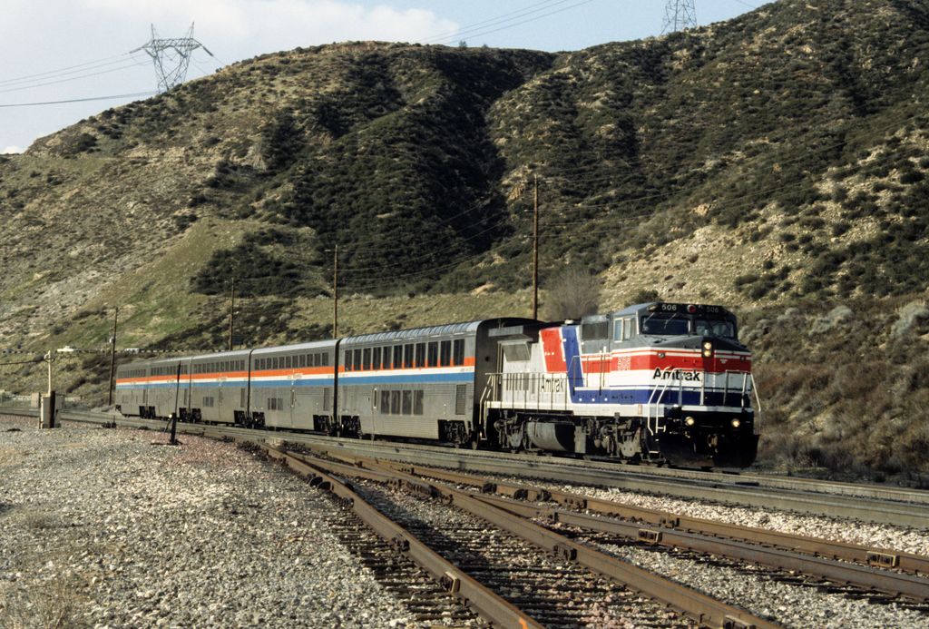
At its peak in 1916, the U.S. rail network reached about 254,000 route miles, and passenger trains reached nearly every county seat. Amtrak’s long-distance trains today serve a different purpose from frequent passenger services in major metropolitan areas. They connect large cities, certainly. But they also serve smaller communities along the way, sometimes providing one of the few alternatives to a long automobile trip.
The Federal Railroad Administration’s Amtrak Daily Long-Distance Service Study, submitted to Congress in January 2025, makes the point clearly: long-distance routes serve nearly half of all Amtrak stations, and fewer than 10 percent of long-distance riders travel from one end of a route to the other. Most get on or off somewhere in between. For a rural resident, a passenger train may provide access to a larger city, medical care, education, or another transportation network. Its value cannot be measured solely by the number of passengers traveling between the endpoints of a route.
Raton shows what that can mean for a small city. The Southwest Chief still stops there daily on its run between Chicago and Los Angeles. Raton’s 2021 comprehensive plan reported more than 16,000 boardings and alightings in 2012, noted that Philmont Scout Ranch crews rely on the train each summer, and made a striking observation: because Amtrak is the only regular user of a long stretch of BNSF’s Raton Line, continued passenger service is “essential to keeping the Raton Line from being abandoned.” In that case, the passenger train is doing more than carrying passengers. It is helping to keep the corridor itself alive.
Passenger rail service faces significant constraints. Outside the Northeast Corridor, Amtrak operates largely over tracks owned by freight railroads, and its reliability depends on how those railroads dispatch and maintain their lines. Commuter rail ownership varies widely. The Long Island Rail Road owns most of its physical network. Some larger metropolitan areas, like Chicago, operate commuter service largely on freight-owned track. Caltrain owns its main line corridor between San Francisco and San Jose. In the Salt Lake area, UTA owns a dedicated, passenger-only right-of-way for its FrontRunner corridor alongside Union Pacific freight tracks. Denver’s RTD owns the active rail infrastructure for most of its FasTracks commuter rail service, although it relies on right-of-way purchased from freight railroads or separate tracks running adjacent to freight corridors.
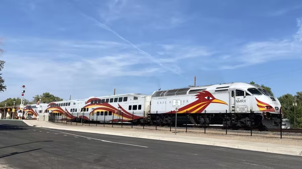
New Mexico offers a rural-edge example. Between 2005 and 2008, the state bought or built about 133 miles of right-of-way to launch the Rail Runner Express between Belen, Albuquerque, and Santa Fe, while BNSF retained freight rights on the line. The Town of Bernalillo has two Rail Runner stations, a 2007 transit-oriented development plan, and a pedestrian safety project along the rail corridor.
Reliability, infrastructure capacity, and operating arrangements depend on decisions that extend far beyond any individual community. A town cannot resolve those national issues through its comprehensive plan. It can, however, influence what happens around its station.
The Light Rail Option
Light rail is almost exclusively an urban passenger transit system, using single railcars or short trains, most often electrically powered from overhead wires. It occupies the middle ground between a streetcar and a subway: it can run in streets or highway medians, on its own surface right-of-way, or through tunnels and elevated sections. “Light” refers principally to passenger capacity relative to heavy rail—not necessarily to the vehicles’ physical weight.
In both the United States and Canada, light rail serves metropolitan travel rather than the long-distance freight and intercity markets discussed above. Its defining advantage is flexibility: one line can connect downtown streets, suburban corridors, and underground stations without changing vehicle technology. Dallas Area Rapid Transit (DART) operates 93 miles of light rail across four lines and 65 stations. Los Angeles Metro’s A Line, extended to Pomona in September 2025, now runs 57.7 miles on its own, which Metro describes as the world’s longest light rail line. The San Diego Trolley has grown to about 65 route miles, reaching the San Ysidro international border crossing.
Light rail is not a realistic option for most rural communities, and we discuss it here mainly for contrast. Its lesson for small towns is about matching the technology to the travel market. A light rail line makes sense where there are enough people and destinations within walking distance of its stations. A once-daily long-distance train, a regional bus, or a demand-response van makes sense under very different conditions. The comprehensive plan should be clear about which market it is planning for.
The Local Connection
A passenger platform surrounded by parking lots, disconnected streets, and highway-oriented development may be difficult to reach without a car. A station connected to downtown sidewalks, local transportation services, bicycle routes, and nearby destinations becomes a more useful community asset. As we discussed last week, access involves the entire trip. A train arriving in town does not, by itself, provide access. Passengers still need to reach their destinations and return to the station for the trip home.
The Town of Bernalillo illustrates the point with some precision. The town has two Rail Runner stations, yet the American Community Survey (ACS) data in its 2022 plan showed only 0.1 percent of residents commuting by transit, down from 1.2 percent in 2010. More than 17 percent of survey respondents said they use the train, but only about 6 percent ride two or three times a month or more. The service is valued, and it is used, but mostly for occasional trips rather than for daily commuting. That is not a failure of the station. It is a reminder that the station’s usefulness depends on what surrounds it, where people work, and whether the schedule fits their lives.
Raton took a different approach to its station. The historic depot became the centerpiece of a multimodal facility, with a covered waiting area for train and bus passengers, a public plaza, and interpretive signs drawn from a cultural-resources study. The project received an ACEC Engineering Excellence Award in 2019. It treats the station as a civic place and a connection point, not merely a platform.
Where passenger rail exists, the comprehensive plan should address station access, surrounding land uses, pedestrian connections, and opportunities to coordinate local transportation with train schedules. Where service has disappeared, preserving a station site or related corridor may retain future options. Grand Island’s plan, for example, notes that the nearest Amtrak station is in Hastings and supports efforts to restore passenger service to the city. But proposals to restore service should be evaluated against realistic questions of demand, operating support, infrastructure requirements, and the participation of responsible agencies.
A rail stop is not yet a connection.
When the Railroad Divides the Town
For many residents, the most direct experience of the railroad is not a freight shipment or a passenger journey. It is waiting at a crossing.
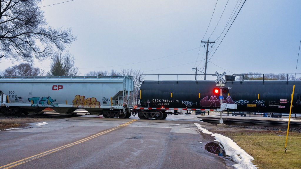
Highway-rail crossings are unavoidable features of many small-town street networks. They can also create serious safety and access problems, especially where a community has grown on both sides of a busy line. A stopped train may block the shortest route between homes and a school, clinic, or fire station. A long freight train may obstruct several crossings at once, leaving drivers with few alternatives. The numbers add up quickly. The Federal Railroad Administration’s crossing inventory counts 87 rail crossings within the Grand Island metropolitan planning area, 65 of them public and at grade.
But crossing problems do not begin and end with railroad operations. They are also shaped by local development decisions. Consider a subdivision proposed beyond the tracks, with its only practical access across a single grade crossing. The site may meet zoning requirements and have adequate road capacity under ordinary conditions. Yet a stopped train could temporarily separate residents from emergency services. Or consider a town choosing a location for a new school, fire station, or major employment center. The railroad’s location—and the reliability of routes across it—should be part of that decision. These are land-use choices with consequences that can last for decades.
Avoiding land use conflicts along the railroad corridor
The plans in this series show how these choices appear in practice. Kimball’s 2024 plan includes a goal that “land use conflicts are avoided along the railroad corridor,” with actions to buffer residential development along the Union Pacific right-of-way and to work with the county and the railroad to improve or close crossings in the city and its extraterritorial jurisdiction. Raton’s plan proposes extending Rio Grande Avenue across the rail yard, which would “cut the distance in half between the existing rail crossings” and improve emergency access to the east side of town.
The Federal Railroad Administration maintains crossing inventory and safety information that communities can use to identify risks and priorities. Since December 2019, it has also run an online portal where residents and local officials can report blocked crossings. That portal comes with two important cautions. First, there are no federal laws or regulations limiting how long a train may block a crossing; the reports are collected to document where, when, and how often crossings are blocked and what impacts result. Second, the FRA does not verify the public reports and states that the data is not suitable for use in budget requests. Local records therefore matter. Emergency-response logs, school transportation reports, and documented delays give a community evidence it can stand behind when it asks for help.
Federal funding can help address some of those problems. The Railroad Crossing Elimination Program’s fiscal year 2025–2026 funding opportunity made up to about $1.147 billion available for grade separations, closures, track relocations, safety improvements, and planning. At least 20 percent was reserved for rural areas and tribal lands, and a separate set-aside supported planning projects. Applications closed in June 2026. What comes next is uncertain. The authorization for federal surface transportation programs, including this one, was set to expire September 30 and has been temporarily extended to December 11, 2026, while Congress works on a new surface transportation bill.
Major projects are expensive, and a municipality rarely has the resources to eliminate every problematic crossing. That makes a coordinated strategy more useful than a collection of unrelated requests. A community may find that closing one little-used crossing, improving another, and protecting land for a future overpass would produce better results than attempting to upgrade every crossing independently. Those choices require careful consideration of neighborhood access, emergency routes, business deliveries, school transportation, and the additional travel a closure might impose.
Grand Island’s Broadwell Avenue project shows that kind of package. Only three of the nine Union Pacific crossings in downtown Grand Island are grade separated. The City now proposes a viaduct carrying Broadwell Avenue over the Union Pacific tracks, combined with the closure of the nearby Pine Street crossing. The City has been working toward it since at least 2019, when it budgeted a feasibility study needed to qualify for state rail safety funds. Final design is expected to continue through late 2027, with construction anticipated in 2029 and 2030. The City has also told nearby property owners that the project may require purchasing land and homes. Grade separation is not just a bridge over the tracks. It is a neighborhood-scale land-use decision.
From Problem to Project: Crawfordsville, Indiana
Crawfordsville, a small city in west-central Indiana, offers a useful example of how a local crossing problem enters the federal project-development process. At Market Street, two state roads and a U.S. highway converge on a CSX crossing in the middle of town. In January 2025, the City announced federal funding for a $1.6 million planning and development project: an FRA Railroad Crossing Elimination grant of up to $1.12 million, with the City contributing the local match even though the crossing sits on state highways.
As far as I can tell, the project has moved steadily since. Planning identified a roadway overpass as the preferred alternative. Environmental review and preliminary engineering are underway, with a public hearing expected in early 2027. The City applied in 2026 for a federal grant to cover final design, right-of-way acquisition, and construction. The total project cost is now estimated at $44.5 million, and if that funding is awarded, construction could begin as early as 2029.
That progression matters. A community does not move directly from identifying a crossing problem to constructing a multimillion-dollar solution. It must establish the need, evaluate alternatives, work with the railroad and transportation agencies, develop a feasible project, and assemble funding, often over five years or more. The comprehensive plan can help establish why such a project matters to the broader community, rather than treating it as an isolated traffic improvement. It can also protect future options, such as right-of-way, access, and compatible adjacent uses, while engineering and funding decisions are still years away.
Quiet Zones Require More Than a Noise Complaint
Train horns are another recurring concern in railroad towns. Under the federal Train Horn Rule, routine horn sounding is generally required as trains approach public highway-rail grade crossings. Since 2005, communities have been able to establish designated quiet zones when the applicable safety conditions are satisfied. As Grand Island’s plan explains, the baseline requirements include flashing lights with gates, constant warning time train detection, and power-off indicators visible to train crews. Depending on the circumstances, additional measures may be required, such as four-quadrant gates, medians or channelization devices, or crossing closures. Not every quiet zone requires the same improvements, and horns may still sound in emergencies.
A quiet zone can improve conditions for residents near the tracks, but it is not simply a noise-control measure. It is a safety and regulatory undertaking with engineering, financial, and ongoing compliance implications. A comprehensive plan can identify whether a quiet zone is a community priority; the actual project must be developed under the applicable federal requirements.
When the Train Carries Hazardous Materials
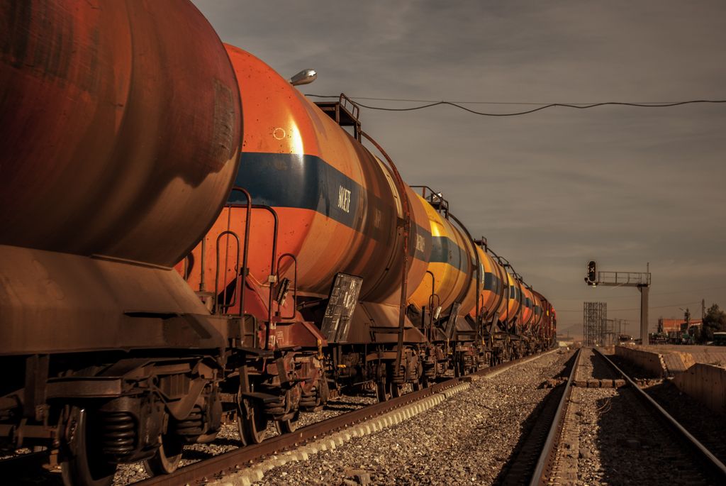
Communities also need to plan for what the trains carry. Fuel, fertilizer, and industrial chemicals move through rural America by rail every day, often through the center of town and past schools, nursing homes, and neighborhoods that grew up beside the tracks. The 2023 derailment in East Palestine, Ohio, reminded many small communities how quickly a railroad emergency can become a local one.
Several tools already exist. Railroads will provide commodity flow information to emergency planners on request, describing the types of hazardous materials moving through a jurisdiction. The AskRail app, developed by the railroads and emergency-response organizations, gives qualified first responders real-time information on what a specific railcar is carrying. Railroads also offer hazardous-materials training to local fire departments. These tools belong in the local emergency operations plan and the county hazard mitigation plan, and the comprehensive plan should be consistent with both. When a community decides where to locate a school, a senior housing project, or a new subdivision, the presence of a hazardous-materials route is part of the land-use picture.
The larger planning lesson is that crossings and corridors form a network, and planning each crossing in isolation misses that responsibility. If nothing else, this is where incorporating your hazard mitigation plan into your comprehensive plan pays off, for both public safety and transportation safety.
A railroad crossing is not merely the place where a road meets the tracks. It is part of the community’s access to schools, jobs, emergency services, and daily life.
Lessons for the Long-Term Corridor
International examples are useful when they illuminate a planning principle rather than suggest that another country’s railroad system can simply be copied.
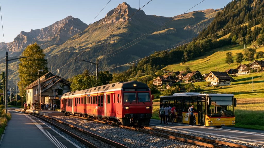
Switzerland’s integrated timetable provides one example. Its rail and bus services are organized around regular connections at important hubs, emphasizing how the network works together rather than treating each service independently. For smaller American communities, the lesson is not that they need Swiss levels of rail investment. It is that an infrequent train, regional bus, or demand-response service becomes more useful when connections are reliable and coordinated. Raton’s combined train-and-bus waiting area at its depot is a small American version of the same idea.
Canada offers a different lesson. Churchill, Manitoba, has no year-round road connection to the rest of Canada. When flooding damaged the Hudson Bay Railway in 2017, the community lost its only land transportation link. In 2018, the Arctic Gateway Group, a partnership that brought together First Nations and northern communities with private investors, acquired the railway and the Port of Churchill with federal support, and the first train in 18 months reached Churchill that November. Ownership has since consolidated in a partnership of First Nations and Bayline communities, and the federal and provincial governments have continued to invest in the line. Churchill is an exceptional case, and community ownership is not a practical solution for most American towns. But it demonstrates that transportation infrastructure can be so important to a community’s future that local interests must have a meaningful role in decisions about its preservation and operation.
France faces a related question with its petites lignes, lightly used regional railways that serve small towns and rural areas. Regions, which organize regional passenger service, have worked with the national government to renovate many of these lines rather than abandon them. The debate is far from settled, but it contrasts with the American pattern, where many lightly used branch lines were abandoned and some became the rail-trails we discussed last week.
Australia offers a freight example, and its lesson has sharpened this year. Inland Rail was designed as a 1,600-kilometer freight railway linking Melbourne and Brisbane through the agricultural interior, mostly by upgrading existing track. After an independent review in 2023, the government staged the project and prioritized the southern sections. Then, in May 2026, an independent cost assessment put the full route at more than A$45 billion, more than three times the budget allocation, with completion no earlier than 2036. The government responded by consolidating the project: it will finish the section between Beveridge, near Melbourne, and Parkes, New South Wales, by the end of 2027, and work with the states to preserve the corridor north of Parkes for possible future construction. For towns along the route, the project has brought construction jobs alongside hard questions about land acquisition, flooding, and what a major freight line means for places it passes through without stopping. For planners, it is a clear example of a government deciding that when it cannot afford to build now, the next best step is to protect the corridor.
The common lesson is not that every community should demand more trains. It is that transportation connections should be evaluated by what they make possible for the places they serve—not simply by how much traffic they carry.
The Corridor Is the Long-Term Asset
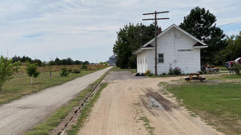
Railroad infrastructure is expensive to build and maintain, and it can be remarkably difficult to replace once removed. A branch line may no longer carry enough freight to justify continued operation, and from the railroad’s perspective, abandonment may be a reasonable business decision. But the consequences for the community can last much longer. Once a right-of-way is divided, sold, or developed, restoring a continuous transportation corridor may become prohibitively expensive—or practically impossible.
The Plains are full of reminders. Our 2024 comprehensive plan for the City of Burwell, Nebraska, notes that its Burlington line has been abandoned for many years and that the nearest rail service is the Nebraska Central short line at Ord. Fairbury, Nebraska, was once the Rock Island’s Western Division headquarters. Some former corridors have found second lives: the Cowboy Trail across northern Nebraska, the Homestead Trail between Lincoln and Beatrice, and Grand Island’s St. Joe Trail on the old St. Joseph & Grand Island Railroad right-of-way. In New Mexico, Aztec’s plan proposes a regional trail on the former Rio Grande Western corridor. Elsewhere, the right-of-way simply dissolved into adjacent farm fields and backyards.
This is where the time horizon of comprehensive planning matters. A railroad operator must evaluate the economics of maintaining a line. A local government must also consider whether the corridor could serve a transportation purpose decades from now, even if its present use has declined. New Mexico’s purchase of right-of-way for the Rail Runner and Australia’s decision to protect the Inland Rail corridor north of Parkes are both examples of public agencies acting on that longer horizon.
Federal railbanking provisions offer one possible tool for eligible corridors. Through a Surface Transportation Board process, a corridor may be preserved through interim trail use while retaining the possibility of future rail service. Railbanking does not guarantee that trains will return. Not every abandoned corridor qualifies, and a local government cannot simply declare a corridor railbanked through its comprehensive plan. The legal status of the line, the interests of property owners, the railroad’s participation, and the willingness of a trail sponsor to assume responsibilities all matter.
Still, the principle is important. A former railroad corridor may support walking and cycling, as we discussed last week. It may also preserve a route that could have future transportation value. Those possibilities should be examined before the corridor is permanently fragmented.
A comprehensive plan should distinguish between active rail lines, inactive lines that remain part of the rail network, corridors undergoing abandonment proceedings, and corridors already abandoned, because those categories carry different legal and practical implications. It should also identify which corridors are strategically important, what actions are available to protect them, and which agencies or organizations would need to participate.
A railroad may make decisions based on the economics of the next decade. A comprehensive plan should consider what the community may need fifty years from now.
What This Means for Rail & the Rural Comprehensive Plan
A comprehensive plan cannot operate a railroad, set freight rates, determine Amtrak schedules, or require a railroad to serve a particular customer. Its role is different. It can establish what the community needs, protect land-use options within local control, identify where rail infrastructure creates risks or opportunities, and provide a consistent basis for working with railroads and other agencies.
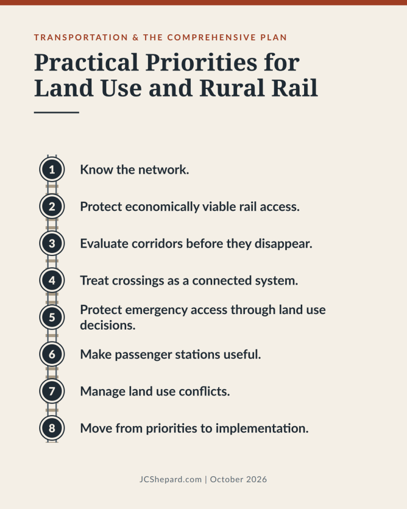
A useful rail component should address eight practical priorities:
- Know the network. Map active rail lines, short lines, sidings, industrial spurs, transload sites, passenger stations, crossings, and former rights-of-way. Identify ownership, operating responsibilities, and legal status where possible.
- Protect economically viable rail access. Identify industrial sites with usable or realistically attainable rail service. Coordinate with operators and economic development partners before assuming a rail connection can support a proposed development.
- Evaluate corridors before they disappear. Identify inactive and potentially abandoned lines whose continuity may have long-term value. Investigate preservation options, including railbanking where legally available, before abandonment or redevelopment forecloses them.
- Treat crossings as a connected system. Combine federal crossing information, safety records, blocked-crossing reports, local emergency-response data, and local knowledge to set priorities for closures, improvements, and grade separations.
- Protect emergency access through land use decisions. Evaluate whether proposed subdivisions, schools, public facilities, and major employers will remain accessible when crossings are blocked. Coordinate contingency routes with emergency-service providers.
- Make passenger stations useful. Where passenger rail exists, connect stations to downtown, pedestrian and bicycle networks, local transportation services, and appropriate nearby development.
- Manage land use conflicts. Consider noise, vibration, crossing safety, and hazardous-materials transportation when locating housing, schools, and other sensitive uses near active rail infrastructure, and keep the plan consistent with the hazard mitigation and emergency operations plans. Avoid creating new conflicts that could constrain existing rail operations.
- Move from priorities to implementation. Participate in state rail planning and federal proceedings that affect local service, identify responsible agencies and potential funding sources, and engage railroad operators and state transportation officials early. Link projects to capital improvement programs, the one- and six-year road plan, and realistic implementation schedules.
A useful next step is to turn the inventory into a short decision matrix: which assets should be protected, which conflicts require action, who has authority, what information is still missing, and what the community can realistically accomplish within the next five to ten years. A simple version might start like this:
| Rail asset or issue | Key planning question | Who holds authority | Local plan tools |
| Rail-served industrial site | Will a railroad serve it, and for whom? | Railroad, property owner | Future land use map, zoning, economic development partnerships |
| Crossing with recurring blockages | Close, improve, or separate? | Railroad, state DOT, FRA, city or county | Crossing inventory, capital improvement program, grant applications |
| Development beyond the tracks | Does it keep a second, reliable access route? | City or county | Subdivision regulations, access standards, facility siting |
| Passenger station or former depot | Can people reach it without a car? | Amtrak or transit agency, city | Sidewalk, trail, and transit connections; downtown zoning |
| Inactive or abandoned branch line | Is the corridor worth keeping whole? | Railroad, STB, adjacent owners | Corridor policy, railbanking or trail partnerships, acquisition |
| Hazardous materials route | Are sensitive uses and responders prepared? | Railroad, emergency management | Hazard mitigation plan, siting policies, responder training |
That is where a comprehensive plan becomes more than a collection of maps and policy statements.
Much of the necessary information already exists. Federal crossing inventories, safety records, railroad maps, state rail plans, commodity flow information, and local land-use data provide a starting point. The challenge is bringing those sources together before individual development approvals or infrastructure projects eliminate better options.
The Test: What Does Your Town Need?
The railroad shaped the geography of rural America. It influenced where towns were founded, where Main Street ran, where industry located, and which communities prospered. Many of those decisions were made more than a century ago, yet their consequences remain visible today. Communities do not get to make those original decisions again, but they can decide how they respond to the railroad that remains.
Is it an economic asset that needs room to serve local industry? A passenger connection that deserves better access? A barrier that complicates emergency response? A corridor whose future value may exceed its present use? In many towns, it is more than one of these. Raton’s railroad is all four at once: a passenger lifeline, a former freight route the city hopes to revive, a divider of its street grid, and a corridor whose survival depends on decisions made far away.
A comprehensive plan cannot guarantee that a railroad will meet every local need. But it can make those needs visible, establish priorities, and protect the community’s options for the future.
What does your town need from the trains that pass through it, and does your comprehensive plan say so?
Next Sunday: Air Service and Regional Economic Development.
John C. Shepard, AICP, is a planner and economic development practitioner with more than thirty years in public-sector and consulting practice, and is incoming chair of the American Planning Association’s Small Town and Rural Planning Division. The views expressed here are his own.
Who doesn’t love a train song?
Harpers offers “The Twenty-Three Best Train Songs Ever Written—Maybe”.
- “Folsom Prison Blues,” by Johnny Cash—yes, it’s a song about prison… and trains.
- “City of New Orleans,” by Steve Goodman
- “The Ballad of John Henry” (traditional folk song, circa 1870)
- “Chattanooga Choo Choo,” by Harry Warren (music) and Mack Gordon (words)
- “Mystery Train,” by Junior Parker
- “The Midnight Special” (traditional folk song, circa 1900)
- “The Wreck of the Old 97.” (unknown, 1924 recording by Vernon Delhart)
- “This Train Is Bound for Glory” (traditional folk song)
- “On the Atchison, Topeka, and the Santa Fe,” music by Harry Warren, lyrics by Johnny Mercer
- “Dixie Flyer,” by Randy Newman
- “500 Miles Away from Home” or the “Railroader’s Lament” (traditional folk song)
- “Downbound Train,” by Bruce Springsteen
- “Rock Island Line” credited to Kelly Pace, 1934
- “Paddy on the Railway” (traditional folk song)
- Freight Train, Freight Train,” by Elizabeth “Libba” Cotten
- “The Ballad of Casey Jones, or, The Brave Engineer” lyrics by Wallace Saunders, to folk tune known as “Jimmie Jones”
- “Casey Jones,” Jerry Garcia (music), Robert Hunter (words), which doesn’t actually have anything to do with trains.
- “Wabash Cannonball,” by J. A. Roff
- “Long Train Running,” by the Doobie Brothers
- “I’ve Been Working on the Railroad” (traditional folk song)
- “Last Train to Clarksville,” by Tommy Boyce and Bobby Hart
- “Midnight Train to Georgia,” by Jim Weatherly
- “Bringin’ in the Georgia Mail,” by Fred Rose
I have opinions. What do you think?
Further Reading
Sources and background
- Federal Railroad Administration — Amtrak Daily Long-Distance Service Study, Final Report (2025): https://fralongdistancerailstudy.org/final-report/
- Federal Railroad Administration — Report to Congress: Blocked Crossing Portal: https://railroads.dot.gov/sites/fra.dot.gov/files/2024-01/FRA%20Report%20to%20Congress_Blocked%20Crossing%20Portal.pdf
- eCFR — 49 CFR Part 222, Appendix A: Approved Supplementary Safety Measures (quiet zones): https://www.ecfr.gov/current/title-49/subtitle-B/chapter-II/part-222/appendix-Appendix%20A%20to%20Part%20222
- Holland & Knight — STB issues procedural schedule in the Union Pacific–Norfolk Southern merger: https://hlc.com/en/publications/all-aboard-surface-transportation-board-stb-issues-procedural-schedule-in-union-pacificnorfolk
- City of Crawfordsville — Market Street Railroad Crossing project: https://www.crawfordsvillecrossing.com
- Seamless Bay Area — Notes from Switzerland: the nationwide system of coordination: https://www.seamlessbayarea.org/blog/2023/6/5/notes-from-switzerland-the-nation-wide-system-of-coordination-for-9m-people
- Government of France — A future for small regional rail lines (in French): https://www.info.gouv.fr/actualite/donner-un-avenir-aux-petites-lignes-ferroviaires
- Arctic Gateway Group — About the Hudson Bay Railway and Port of Churchill: https://www.arcticgateway.com/about
- Australian Government — Inland Rail: https://www.infrastructure.gov.au/inlandrail
Breaking Commentary
- Economic Developer & Commentator Dean Barber led his substack this weekend with “Why America Can’t Get High-Speed Rail Right: Automobile, oil and aviation interests pushed passenger rail into the background“. Behind the paywall, but Dean does offer a 7-day free trial.
Books
- Nature’s Metropolis: Chicago and the Great West by William Cronon (W.W. Norton & Co, 1991)
One of my favorite non-fiction books, this is a classic on how railroads, grain elevators, and markets shaped the rural Midwest, and the best background reading for this article. - Plains Country Towns by John C. Hudson (University of Minnesota Press, 1985)
A foundational study of how the railroads platted small towns (including those who became big cities) across Middle America. - Amtrak, America’s Railroad: Transportation’s Orphan and Its Struggle for Survival (Railroads Past and Present) by Doughty, Darbee, and Harmon (Indiana University Press, 2021)
The story of founding of the Amtrak passenger rail system in the U.S. - Light Rail Transit Systems: 61 Lessons in Sustainable Urban Development by van der Bijl, et al. (Elsevier, 2018)
How to design and operate light rail to maximize social benefits, featuring 50+ case studies from Europe, the US, and the Middle East. - American Railroads: Decline and Renaissance in the Twentieth Century by Robert E. Gallamore and John R. Meyer (Harvard University Press, 2014)
The economics and policy behind consolidation, abandonment, and the freight railroads across the United States. - The Great Railroad Revolution: The History of Trains in America by Christian Wolmar (Public Affairs, 2012)
A readable account of how the railroad built American towns, and how much of it was later lost. - Nothing Like It in the World: The Men Who Built the Transcontinental Railroad, 1863-1869 by Stephen E. Ambrose (Simon & Schuster, 2000)
The author of Undaunted Courage tells the engaging story of the race to complete the first railroad connecting the east and west coast of the United States. - Confessions of A Recovering Engineer: Transportation for a Strong Town by Charles Marohn (Wiley, 2021)
Chuck Marohn delivers a vision for more accessible and engaging local transportation systems in his second book in the Strong Towns series. He delivers withering critiques of his chosen profession, yet also offers real-world examples of communities doing better for all residents. Our October 2026 featured book of the month.
As an Amazon Associate, jcshepard.com earns from qualifying purchases. This does not affect the price you pay or our recommendations.
If you like model railroading, check out Spring Creek Model Trains in beautiful downtown Deshler, Nebraska, and online. They are at train shows in Beatrice, Nebraska, and Greeley, Colorado, this weekend.
If you like books about planning and related topics, be sure to check out the Booked on Planning Podcast, a special project of the APA Nebraska Chapter with national reach.
Resources
Rural-Ready Engagement: Practical Tools for Small Town Planners
 Watch the full replay: youtube.com/@Engaging-Communities (February 2026). Community engagement can look very different in small towns and rural communities. This webcast was co-sponsored by the APA Community Engagement Interest Group and the Small Town & Rural Planning Division.
Dynamic Decisions Podcast (Season 2 Episode 15)
“Stop Chasing Smokestacks. Grow What You Have” with Teasha Cable of cModel Data, now playing on Youtube (audio), Apple Podcasts, Spotify (May 2026). Other listening links here.
The Rural Impact Podcast (Episode #86)
“Pathways to Powering Rural America” My guest spot on Michelle Rathman’s podcast. Episode page here, listen on Apple Podcasts or Spotify, or watch (!) on youtube. We talked about energy, data centers, and good governance, plus so much more.
Popular posts on JCShepard.com
- The Planning Process—From Vision to Action in Small Towns and Rural America (January 2026)
- Historic Preservation and Rural Economic Development: A Rural Growth Strategy (April 2026)
- Small Towns Can Build a Strong Outdoor Economy Without Selling Out (June 2026)
- The Rise of Rural Entrepreneurship: Building Economies from the Ground Up (January 2026 on Medium.com)
- When the Zoning Code Works Against the Plan (September 2026 just last month!)
- Reviving Rural America: Why Heritage Tourism Is a Game-Changer Now (September 2025)
- Main Street America and the Revival of Downtown (June 2026)
- What is Economic Development in Modern America? A Field Guide for Small Towns and Rural Places (March 2026)
- Rethinking the Rural Economy: New Paths, New Possibilities for Growth (August 2025) / Rural Entrepreneurship: Building Economies from the Ground Up (August 2026 on Medium.com)
- How Small Towns Succeed: A Proven Playbook for Rural Action (November 2025)
- Is Rural Really the Same as Non-Metro? (February 2026)
- Revitalizing Main Street the Idea-Friendly Way (August 2026 on Medium.com)
- Small Towns, Big Impact: How Rural Communities Are Designing Their Own Futures (November 2026)
- Floodplain Management and the Comprehensive Plan: Beyond the FEMA Flood Map (August 2026)
- Stop Chasing Smokestacks: A Practical Guide to Small‑Town Economic Development (May 2026)
- Soils and the Comprehensive Plan: What Your Soil Survey Is Trying to Tell You (July 2026)
Check out The 12 Planning & Sustainability Books You Need in 2026 and browse through the Small Town & Rural Community guides on our Resources page.
.